|
search place name
|
||
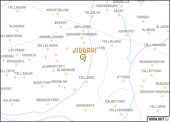
Jiddāwī (Al Ḩasakah, Syria)Jiddāwī is a town in the Al Ḩasakah region of Syria. An overview map of the region around Jiddāwī is displayed below.
regional and 3d topo map of Jiddāwī, Syria ::
Jiddāwī airports ::
The nearest airport is BAL - Batman, located 133.2 km north west of Jiddāwī.
Other airports nearby include DIY - Diyabakir Diyarbakir (181.2 km north west), DEZ - Deire Zor Deir Zzor (225.4 km south west), VAN - Van (226.3 km north east), Nearby towns ::
Umm Kuhayf Taḩtānī (2.2km north east) //
‘Unayzah (4.0km north) //
Tall Qawz (4.6km south) //
Şāfiyah Jawwālā (4.1km north west) //
Al Haramah (4.3km south west) //
Umm Kuhayf Fawqānī (5.0km north) //
Tall Ḩaddād (5.0km west) //
Khirbat al Biʼr (5.3km west) //
Al Luhābīyah (6.5km south) //
Baylūnah (6.7km north) //
Tall al Hādī (5.8km north east) //
Jilbārāt Ţayy (5.9km west) //
Kalb A(246)rāt (6.8km south west) //
Ḩarmalah (7.0km south west) //
Mushallashah (7.4km north west) //
Tall al Hāmir (7.1km west) //
Khirbat al Bāgh (7.0km west) //
Qaşrūk (8.6km north west) //
Aţ Ţāsh (8.1km south east) //
[all distances 'as the bird flies' and approximate] 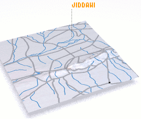 Places with similar names to Jiddāwī, Syria ::
Disclaimer :: Information on this page comes without warranty of any kind |
||
|
Where is Jiddāwī? Elevation and coordinates ::
Latitude (lat): 36°50'57"N Longitude (lon): 41°46'23"E
Elevation (approx.): 374m (map arrows pan, magnifying glasses zoom) |
||
|
Visiting Jiddāwī? Hotel/Accommodation ::
Book a hotel in Jiddāwī Travel Guide ::
Buy a travel guide for Syria rental cars ::
car rental offers GPS waypoint ::
download a GPX waypoint (PoI) of Jiddāwī for your GPS receiver
|
||