|
search place name
|
||
Kafr Nabūdah (Ḩamāh, Syria)Kafr Nabūdah is a town in the Ḩamāh region of Syria. An overview map of the region around Kafr Nabūdah is displayed below.
regional and 3d topo map of Kafr Nabūdah, Syria ::

Kafr Nabūdah airports ::
The nearest airport is LTK - Latakia Bassel Al Assad Intl, located 48.7 km west of Kafr Nabūdah.
Other airports nearby include ALP - Aleppo Intl (106.6 km north east), GZT - Gaziantep Oguzeli (190.3 km north east), PMS - Palmyra (193.6 km south east), ADA - Adana Incirlik Ab (198.3 km north west), Nearby towns ::
‘Utayzilah (1.9km south) //
Al Ḩawāsh (3.0km west) //
Maghāʼir (3.7km south) //
Qarah Jurn (3.7km north) //
Al Habīţ (3.0km east) //
Al Muqayr (3.8km south) //
Al Ḩayrāt (3.5km north west) //
Qīrāţah (4.8km north west) //
Al Qārūţīyah (4.8km north west) //
Suţūḩ ad Dayr (5.6km north) //
Kurnāz (5.6km south) //
Ba‘rabū (5.8km north) //
Qa‘ūrah (5.5km north west) //
Buraydīj (6.3km south west) //
Şahrīyah (5.9km north west) //
Uraynibah (7.6km north) //
Warmīyah (8.0km north) //
Al Ḩamāmīyāt (8.7km south east) //
Dayr Sunbul (8.7km north west) //
Muqayyar (8.7km north east) //
[all distances 'as the bird flies' and approximate] 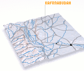 Places with similar names to Kafr Nabūdah, Syria :: Disclaimer :: Information on this page comes without warranty of any kind |
||
|
Where is Kafr Nabūdah? Elevation and coordinates ::
Latitude (lat): 35°26'0"N Longitude (lon): 36°29'0"E
Elevation (approx.): 297m (map arrows pan, magnifying glasses zoom) |
||
|
Visiting Kafr Nabūdah? Hotel/Accommodation ::
Book a hotel in Kafr Nabūdah Travel Guide ::
Buy a travel guide for Syria rental cars ::
car rental offers GPS waypoint ::
download a GPX waypoint (PoI) of Kafr Nabūdah for your GPS receiver
|
||