|
search place name
|
||
Khalfah (Ḩimş, Syria)Khalfah is a town in the Ḩimş region of Syria. An overview map of the region around Khalfah is displayed below.
regional and 3d topo map of Khalfah, Syria ::

Khalfah airports ::
The nearest airport is PMS - Palmyra, located 108.7 km east of Khalfah.
Other airports nearby include LTK - Latakia Bassel Al Assad Intl (127.5 km north west), ALP - Aleppo Intl (143.5 km north), DAM - Damascus Intl (175.6 km south), BEY - Beirut Rafic Hariri Intl (197.0 km south west), Nearby towns ::
Khilfah (0.5km south) //
Tall ‘Udayy (3.2km north) //
Khirbat Khalfah (3.4km south east) //
Tall al Qaţā (3.6km north east) //
Khirbat ‘Ayyāsh (4.4km south) //
Shaykh Rīḩ (5.8km north west) //
Tall al Jadīd (5.6km north east) //
Abū Ḩakfā al Janūbī (5.3km west) //
Musayyid (6.2km south east) //
Munţār al ‘Abl (6.2km south east) //
Umm Ḩāratayn al Gharbīyah (6.2km east) //
Buwayḑat Ruwayḩīnī (6.5km west) //
Bāb al Hawāʼ (7.9km south) //
As Sa‘dīyah (6.8km south west) //
Khāfīyah (7.6km north west) //
Abū Ḩakfā ash Shamālī (6.7km west) //
Duwayr al Gharbī (8.4km south) //
Tall al Ward (8.4km south) //
Tall Furaytān (8.3km north east) //
Furaytān (8.7km north east) //
Al Qalbīyah (8.4km north west) //
Malţah (9.5km north west) //
Burghūthīyah (9.2km north east) //
Duwayr ash Sharqī (10.0km south east) //
Sankarī ash Shamālī (10.0km south west) //
Barghūtīyah (10.4km north east) //
Tall al Ḩatt (10.7km north east) //
Tall ash Shaykh ‘Alī (10.7km north west) //
[all distances 'as the bird flies' and approximate] 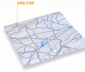 Places with similar names to Khalfah, Syria ::
Disclaimer :: Information on this page comes without warranty of any kind |
||
|
Where is Khalfah? Elevation and coordinates ::
Latitude (lat): 34°53'15"N Longitude (lon): 37°12'0"E
Elevation (approx.): 643m (map arrows pan, magnifying glasses zoom) |
||
|
Visiting Khalfah? Hotel/Accommodation ::
Book a hotel in Khalfah Travel Guide ::
Buy a travel guide for Syria rental cars ::
car rental offers GPS waypoint ::
download a GPX waypoint (PoI) of Khalfah for your GPS receiver
|
||