|
search place name
|
||
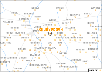
Kuwayr Rāsh (Al Ḩasakah, Syria)Kuwayr Rāsh is a town in the Al Ḩasakah region of Syria. An overview map of the region around Kuwayr Rāsh is displayed below.
regional and 3d topo map of Kuwayr Rāsh, Syria ::
Kuwayr Rāsh airports ::
The nearest airport is BAL - Batman, located 99.2 km north of Kuwayr Rāsh.
Other airports nearby include DIY - Diyabakir Diyarbakir (135.4 km north west), DEZ - Deire Zor Deir Zzor (220.2 km south west), Nearby towns ::
Jemâïyé (0.4km north west) //
Na‘matlī (1.3km east) //
Da‘dūshīyah (2.0km south east) //
Sharkīb (1.8km west) //
Khirbat Ḩamū (1.8km west) //
Shūtī (2.7km east) //
Dīyū (3.4km south) //
Laţīfīyah (3.4km north) //
Quşayr (3.1km south east) //
Qarah Ḩasan (3.5km north east) //
Khaybak (3.5km north east) //
Khirbat Khālid (4.2km north) //
‘Uwayjah (3.6km south west) //
Ḩāmū (4.3km south east) //
‘Antarīyah (4.0km west) //
Duruca (5.1km north) //
Shūrak (4.2km east) //
As Salām ‘Alayk (5.3km south) //
Jirnak (4.7km north west) //
Tall ash Shaykh ‘Ujayl (5.5km south) //
Tall Arbāţ (6.1km south) //
Mas‘adah (6.3km south) //
Tall Buraysh (6.3km south east) //
Ḩumayrah (5.8km south west) //
Junaydīyah (6.6km south) //
Nergizli (6.0km north east) //
Al Muzayrīb (5.9km east) //
Dabbānah (6.9km south west) //
Tall Ziwān (6.1km east) //
[all distances 'as the bird flies' and approximate]  Places with similar names to Kuwayr Rāsh, Syria ::
Disclaimer :: Information on this page comes without warranty of any kind |
||
|
Where is Kuwayr Rāsh? Elevation and coordinates ::
Latitude (lat): 37°2'50"N Longitude (lon): 41°18'10"E
Elevation (approx.): 429m (map arrows pan, magnifying glasses zoom) |
||
|
Visiting Kuwayr Rāsh? Hotel/Accommodation ::
Book a hotel in Kuwayr Rāsh Travel Guide ::
Buy a travel guide for Syria rental cars ::
car rental offers GPS waypoint ::
download a GPX waypoint (PoI) of Kuwayr Rāsh for your GPS receiver
|
||