|
search place name
|
||
Mamdūḩah (Al Ḩasakah, Syria)Mamdūḩah is a town in the Al Ḩasakah region of Syria. An overview map of the region around Mamdūḩah is displayed below.
regional and 3d topo map of Mamdūḩah, Syria ::

Mamdūḩah airports ::
The nearest airport is BAL - Batman, located 117.7 km north west of Mamdūḩah.
Other airports nearby include VAN - Van (181.6 km north east), DIY - Diyabakir Diyarbakir (182.4 km north west), DEZ - Deire Zor Deir Zzor (270.0 km south west), Nearby towns ::
Şāliḩah (1.6km south) //
Ismā‘īlīyah (2.3km south west) //
‘Akkā (2.7km north east) //
Shaymātah (2.5km south east) //
Taşhöyük (3.2km north) //
Jārūdīyah (2.8km south west) //
Ḩājjī Maţar (3.0km north east) //
Yūnisīyah (2.8km east) //
Kebeli (2.8km west) //
As Safḩ (3.6km south) //
Qaḑāʼ Rajab (3.0km east) //
As Suwaydah (3.5km west) //
Erdem (4.4km north east) //
Ḩaţţīn (4.5km south east) //
Varlık (5.1km north) //
Ḩayākah (5.2km south west) //
Yağmurca (5.1km west) //
Korucu (6.2km north) //
Okçu (6.2km north west) //
Shamsīyah (5.9km north east) //
Tall aş Şidq (5.9km south east) //
Bāb al Hawá (5.6km east) //
Tall Aşfar (5.5km east) //
Ar Ruḩaybah (7.0km south) //
Aş Şuḩbah (7.0km south east) //
Bānūkīyah (6.3km south west) //
Al Firdaws (6.2km west) //
Qilqīlyā (7.3km south west) //
Kīr Zérik (6.7km east) //
[all distances 'as the bird flies' and approximate] 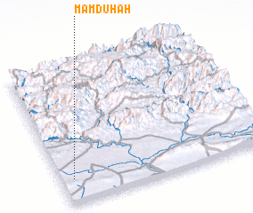 Places with similar names to Mamdūḩah, Syria :: Disclaimer :: Information on this page comes without warranty of any kind |
||
|
Where is Mamdūḩah? Elevation and coordinates ::
Latitude (lat): 37°10'48"N Longitude (lon): 42°3'36"E
Elevation (approx.): 560m (map arrows pan, magnifying glasses zoom) |
||
|
Visiting Mamdūḩah? Hotel/Accommodation ::
Book a hotel in Mamdūḩah Travel Guide ::
Buy a travel guide for Syria rental cars ::
car rental offers GPS waypoint ::
download a GPX waypoint (PoI) of Mamdūḩah for your GPS receiver
|
||