|
search place name
|
||
Qulay‘ah at Taḩtānī (Al Ḩasakah, Syria)Qulay‘ah at Taḩtānī is a town in the Al Ḩasakah region of Syria. An overview map of the region around Qulay‘ah at Taḩtānī is displayed below.
regional and 3d topo map of Qulay‘ah at Taḩtānī, Syria ::

Qulay‘ah at Taḩtānī airports ::
The nearest airport is DIY - Diyabakir Diyarbakir, located 124.0 km north of Qulay‘ah at Taḩtānī.
Other airports nearby include BAL - Batman (158.4 km north east), DEZ - Deire Zor Deir Zzor (166.6 km south), EZS - Elazig (213.2 km north), MLX - Malatya Erhac (252.1 km north west), Nearby towns ::
Qaţţīnah (1.9km north) //
Qulay‘ah al Fawqānī (2.4km south east) //
Umm Dibs (4.0km south) //
Tall Barām (4.0km south) //
Tall Ḩalaf (4.7km north west) //
Biʼr Rāzah (4.5km east) //
Tall Junaydīyah (6.3km south east) //
Ceylanpınar (7.5km north) //
Raʼs al ‘Ayn (7.7km north) //
Abū Jarādah (6.3km west) //
Abū Ḩajar (7.1km north east) //
Al Buwayḑah (7.1km south east) //
Annqara (7.0km north west) //
Tall Barqah (9.5km south east) //
[all distances 'as the bird flies' and approximate] 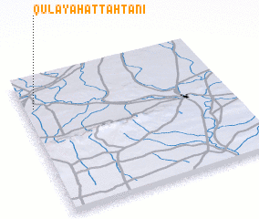 Places with similar names to Qulay‘ah at Taḩtānī, Syria :: Disclaimer :: Information on this page comes without warranty of any kind |
||
|
Where is Qulay‘ah at Taḩtānī? Elevation and coordinates ::
Latitude (lat): 36°47'0"N Longitude (lon): 40°3'0"E
Elevation (approx.): 348m (map arrows pan, magnifying glasses zoom) |
||
|
Visiting Qulay‘ah at Taḩtānī? Hotel/Accommodation ::
Book a hotel in Qulay‘ah at Taḩtānī Travel Guide ::
Buy a travel guide for Syria rental cars ::
car rental offers GPS waypoint ::
download a GPX waypoint (PoI) of Qulay‘ah at Taḩtānī for your GPS receiver
|
||