|
search place name
|
||
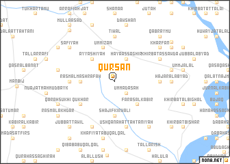
Qurşān (Ḩalab, Syria)Qurşān is a town in the Ḩalab region of Syria. An overview map of the region around Qurşān is displayed below.
regional and 3d topo map of Qurşān, Syria ::
Qurşān airports ::
The nearest airport is GZT - Gaziantep Oguzeli, located 72.0 km north west of Qurşān.
Other airports nearby include ALP - Aleppo Intl (87.8 km south west), MLX - Malatya Erhac (211.1 km north), PMS - Palmyra (220.1 km south), Nearby towns ::
Karsān (1.0km north) //
Umm ‘Adasah (2.4km south east) //
Ḩāyā al Kabīr (4.0km north) //
Ḩāyā aş Şaghīr (4.0km north) //
Faras al Kabīr (4.8km south east) //
Jubb al Kalb al Kabīr (4.8km north west) //
‘Ayyāshīyah (4.8km north west) //
Shajīf Kirwālī (5.6km south) //
Rasm al Mashrafah (4.5km west) //
Umm ‘Iz̧ām (5.8km north) //
Qukhār (5.8km south west) //
Mashrafah aş Şaghīrah (6.0km west) //
Ar Rātūnīyah (6.0km east) //
Ţiwāl (7.4km north) //
Ush Qanah at Taḩtānīyah (7.6km south) //
Shajīf adh Dhahabīyah (8.0km south) //
Khirbat as Sawdāʼ (7.0km north east) //
Faras aş Şaghīr (8.7km south east) //
Şāfiyah (8.1km north west) //
Kharfān (8.1km north east) //
Jubb aţ Ţawīl (9.5km south west) //
Qabr Aymū (9.5km north east) //
Mawlá As‘ad (10.2km north west) //
[all distances 'as the bird flies' and approximate]  Places with similar names to Qurşān, Syria ::
Disclaimer :: Information on this page comes without warranty of any kind |
||
|
Where is Qurşān? Elevation and coordinates ::
Latitude (lat): 36°32'0"N Longitude (lon): 38°6'0"E
Elevation (approx.): 474m (map arrows pan, magnifying glasses zoom) |
||
|
Visiting Qurşān? Hotel/Accommodation ::
Book a hotel in Qurşān Travel Guide ::
Buy a travel guide for Syria rental cars ::
car rental offers GPS waypoint ::
download a GPX waypoint (PoI) of Qurşān for your GPS receiver
|
||