|
search place name
|
||
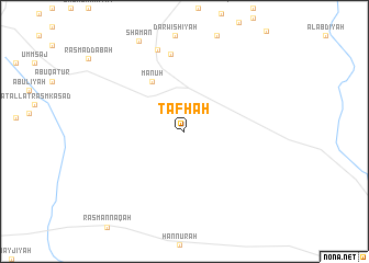
Ţafḩah (Ḩimş, Syria)Ţafḩah is a town in the Ḩimş region of Syria. An overview map of the region around Ţafḩah is displayed below.
regional and 3d topo map of Ţafḩah, Syria ::
Ţafḩah airports ::
The nearest airport is PMS - Palmyra, located 77.1 km east of Ţafḩah.
Other airports nearby include LTK - Latakia Bassel Al Assad Intl (162.1 km north west), DAM - Damascus Intl (166.2 km south west), ALP - Aleppo Intl (169.2 km north), BEY - Beirut Rafic Hariri Intl (206.9 km south west), Nearby towns ::
Manūḩ (5.8km north west) //
Zaghrūtīyah (8.0km north) //
An Nuşayr (8.6km north) //
[all distances 'as the bird flies' and approximate] 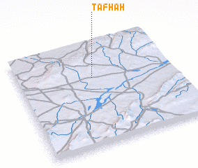 Places with similar names to Ţafḩah, Syria ::
Disclaimer :: Information on this page comes without warranty of any kind |
||
|
Where is Ţafḩah? Elevation and coordinates ::
Latitude (lat): 34°40'15"N Longitude (lon): 37°29'15"E
Elevation (approx.): 822m (map arrows pan, magnifying glasses zoom) |
||
|
Visiting Ţafḩah? Hotel/Accommodation ::
Book a hotel in Ţafḩah Travel Guide ::
Buy a travel guide for Syria rental cars ::
car rental offers GPS waypoint ::
download a GPX waypoint (PoI) of Ţafḩah for your GPS receiver
|
||