|
search place name
|
||
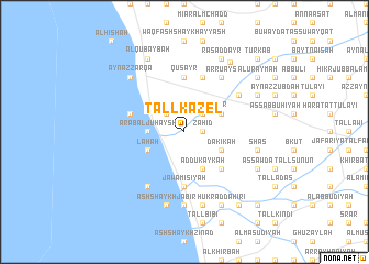
Tall Kazel (Ţarţūs, Syria)Tall Kazel is a town in the Ţarţūs region of Syria. An overview map of the region around Tall Kazel is displayed below.
regional and 3d topo map of Tall Kazel, Syria ::
Tall Kazel airports ::
The nearest airport is LTK - Latakia Bassel Al Assad Intl, located 77.8 km north of Tall Kazel.
Other airports nearby include BEY - Beirut Rafic Hariri Intl (107.6 km south west), DAM - Damascus Intl (151.2 km south), RPN - Rosh Pina Mahanaim I Ben Yaakov (194.4 km south), ALP - Aleppo Intl (199.2 km north east), Nearby towns ::
Zāhid (1.5km east) //
Al Jammāsah (2.4km north west) //
Ḑahr al Ḩajar (2.4km north east) //
Qal‘at Yuḩmur (2.4km north east) //
Huwaysīyah (2.4km north east) //
‘Arab al Juḩaysh (3.0km west) //
Laḩah (3.6km south west) //
Ad Dukaykah (4.0km south) //
Ar Rayḩānīyah (3.6km north east) //
Dakīkah (3.6km south east) //
Al Buşayşah (4.8km south east) //
Quşayr (5.6km north) //
Jawāmīsīyah (5.6km south) //
Al Ḩamīdīyah (4.9km west) //
Bḩūzī (5.8km north) //
Ḑahr ad Duwayr (5.9km north east) //
Al Kharābah (6.3km south west) //
Ar Ruʼays (6.3km north east) //
Al ‘Arīḑah (7.4km south) //
Ash Shaykh Jābir (7.6km south) //
Shāş (6.4km east) //
As Summāaīyah (7.6km south) //
Banī Na‘īm (7.6km south) //
‘Ayn az Zarqāʼ (7.2km north west) //
Matn aş Şafşāfah (7.1km north east) //
Al Qubaybah (8.0km north) //
Aş Şafşāfah (7.1km north east) //
As Sawdāʼ (7.1km south east) //
Raʼs ad Dayr (8.0km north) //
[all distances 'as the bird flies' and approximate] 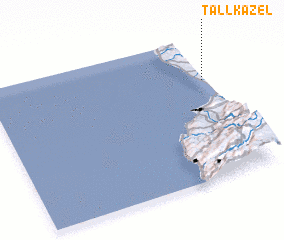 Places with similar names to Tall Kazel, Syria ::
Disclaimer :: Information on this page comes without warranty of any kind |
||
|
Where is Tall Kazel? Elevation and coordinates ::
Latitude (lat): 34°42'0"N Longitude (lon): 35°59'0"E
Elevation (approx.): 12m (map arrows pan, magnifying glasses zoom) |
||
|
Visiting Tall Kazel? Hotel/Accommodation ::
Book a hotel in Tall Kazel Travel Guide ::
Buy a travel guide for Syria rental cars ::
car rental offers GPS waypoint ::
download a GPX waypoint (PoI) of Tall Kazel for your GPS receiver
|
||