|
search place name
|
||
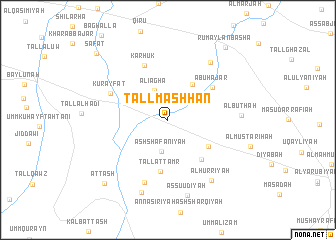
Tall Mashḩan (Al Ḩasakah, Syria)Tall Mashḩan is a town in the Al Ḩasakah region of Syria. An overview map of the region around Tall Mashḩan is displayed below.
regional and 3d topo map of Tall Mashḩan, Syria ::
Tall Mashḩan airports ::
The nearest airport is BAL - Batman, located 136.8 km north west of Tall Mashḩan.
Other airports nearby include DIY - Diyabakir Diyarbakir (189.3 km north west), VAN - Van (216.9 km north east), DEZ - Deire Zor Deir Zzor (235.6 km south west), Nearby towns ::
Ash Sha‘fānīyah (3.6km south) //
‘Alī Āghā (3.5km north) //
Al Junaydīyah (4.6km north east) //
Ad Duwaym (4.7km south east) //
Al Uşayli‘ (5.4km south east) //
Tall at Tamr (5.8km south) //
Abū Ḩajar (5.4km north east) //
Karhūk (6.4km north) //
Kurayfāt (5.9km north west) //
An Nāşirīyah (7.3km south) //
Al Yūsufīyah (7.4km north east) //
Al Būthah (6.6km east) //
Al Ḩurrīyah (7.9km south east) //
Al Būthah (8.5km south) //
As Su‘ūdīyah (8.6km south) //
Aţ Ţāsh (9.0km south west) //
Rumaylān Bāshā (9.6km north east) //
Şafāt (9.8km north west) //
[all distances 'as the bird flies' and approximate] 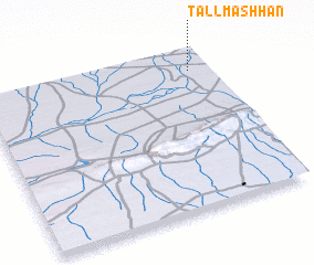 Places with similar names to Tall Mashḩan, Syria ::
// Tall-e Mīchān (IR)
Disclaimer :: Information on this page comes without warranty of any kind |
||
|
Where is Tall Mashḩan? Elevation and coordinates ::
Latitude (lat): 36°52'23"N Longitude (lon): 41°54'46"E
Elevation (approx.): 395m (map arrows pan, magnifying glasses zoom) |
||
|
Visiting Tall Mashḩan? Hotel/Accommodation ::
Book a hotel in Tall Mashḩan Travel Guide ::
Buy a travel guide for Syria rental cars ::
car rental offers GPS waypoint ::
download a GPX waypoint (PoI) of Tall Mashḩan for your GPS receiver
|
||