|
search place name
|
||
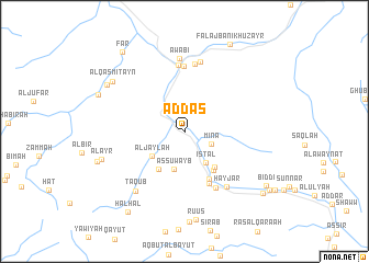
Ad Das (Oman)Ad Das is a town in Oman. An overview map of the region around Ad Das is displayed below.
regional and 3d topo map of Ad Das, Oman ::
Ad Das airports ::
The nearest airport is MCT - Muscat Seeb Intl, located 86.0 km north east of Ad Das.
Other airports nearby include FJR - Fujeirah Fujairah Intl (241.2 km north west), Nearby towns ::
Min‘ā (2.8km south east) //
Isţāl (3.8km south east) //
As Suwayb (4.0km south) //
Al Jaylah (3.9km south west) //
Al Hijīr (4.6km south west) //
Far‘ (4.6km south east) //
Misfah (4.8km south east) //
Şunaybah (5.4km south east) //
Shuwah (5.7km south east) //
Thāqib (6.4km south east) //
Z̧ahūr (6.6km north) //
Bayt al ‘Awābī (6.8km north) //
Layjah (6.9km north) //
Ḩayjar (6.9km south east) //
Ţawī Sīḩ (7.2km north) //
‘Awābī (7.5km north) //
Taqub (7.6km south west) //
Al ‘Ayr (8.3km west) //
Al Qaşmitayn (8.4km north west) //
Al Wāsiţ (8.7km north west) //
Sumaysim (8.8km west) //
Ţīkhah (8.8km north west) //
Falaj Banī Khuzayr (9.8km north east) //
Biddī (9.4km south east) //
Ḩalḩāl (9.8km south west) //
Far‘ (9.9km north west) //
Misfāh ash Shurayqīyīn (9.7km south east) //
At Tīkhah (10.0km south east) //
[all distances 'as the bird flies' and approximate]  Places with similar names to Ad Das, Oman ::
Disclaimer :: Information on this page comes without warranty of any kind |
||
|
Where is Ad Das? Elevation and coordinates ::
Latitude (lat): 23°14'21"N Longitude (lon): 57°32'7"E
Elevation (approx.): 988m (map arrows pan, magnifying glasses zoom) |
||
|
Visiting Ad Das? Hotel/Accommodation ::
Book a hotel in Ad Das Travel Guide ::
Buy a travel guide for Oman rental cars ::
car rental offers GPS waypoint ::
download a GPX waypoint (PoI) of Ad Das for your GPS receiver
|
||