|
search place name
|
||
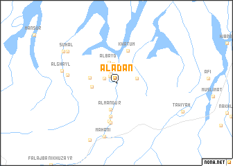
Al‘Adan (Oman)Al‘Adan is a town in Oman. An overview map of the region around Al‘Adan is displayed below.
regional and 3d topo map of Al‘Adan, Oman ::
Al‘Adan airports ::
The nearest airport is MCT - Muscat Seeb Intl, located 65.0 km east of Al‘Adan.
Other airports nearby include FJR - Fujeirah Fujairah Intl (230.4 km north west), Nearby towns ::
Ḩajar (1.4km north west) //
As Suwayr (1.9km west) //
Ḩayi (2.1km north west) //
Abyaḑ (2.7km north) //
Ash Shū‘īyah (2.7km north) //
Al Abyaḑ (3.1km north) //
Şulāwah (3.1km east) //
Al Bayd (3.5km north) //
Al Jaylah (3.7km west) //
Al Ḩasīn (4.0km west) //
Al Manḑūr (4.4km south) //
Khātum (5.4km north) //
Al Barmīyah (5.5km south) //
Şubaykhah (6.3km south) //
Al Mazra‘ah (6.5km south) //
Wukābah (7.4km west) //
Mahānī (8.8km south) //
Al Ghayl (8.3km west) //
Suhal (8.8km north west) //
Maḩyūl (9.3km north west) //
[all distances 'as the bird flies' and approximate] 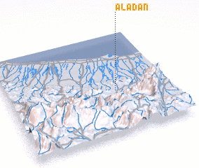 Places with similar names to Al‘Adan, Oman ::
Disclaimer :: Information on this page comes without warranty of any kind |
||
|
Where is Al‘Adan? Elevation and coordinates ::
Latitude (lat): 23°26'17"N Longitude (lon): 57°40'16"E
Elevation (approx.): 258m (map arrows pan, magnifying glasses zoom) |
||
|
Visiting Al‘Adan? Hotel/Accommodation ::
Book a hotel in Al‘Adan Travel Guide ::
Buy a travel guide for Oman rental cars ::
car rental offers GPS waypoint ::
download a GPX waypoint (PoI) of Al‘Adan for your GPS receiver
|
||