|
search place name
|
||
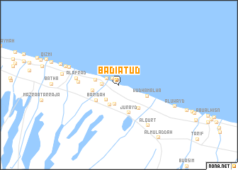
Badī‘at ‘Ūd (Oman)Badī‘at ‘Ūd is a town in Oman. An overview map of the region around Badī‘at ‘Ūd is displayed below.
regional and 3d topo map of Badī‘at ‘Ūd, Oman ::
Badī‘at ‘Ūd airports ::
The nearest airport is MCT - Muscat Seeb Intl, located 83.1 km east of Badī‘at ‘Ūd.
Other airports nearby include FJR - Fujeirah Fujairah Intl (186.5 km north west), RKT - Ras Al Khaimah Intl (254.0 km north west), SHJ - Sharjah Intl (261.6 km north west), Nearby towns ::
Sūr Ma‘āwil (1.3km north west) //
Khabbah (1.3km north west) //
Buday‘ah (2.0km north west) //
Al Ghū (2.4km west) //
Al Musayḩ (3.0km south west) //
Tharmad (3.1km south) //
Ḩamīzah (3.4km south west) //
Al Bid‘ah (3.5km west) //
Ţubbah (3.9km west) //
Baridah (4.0km south west) //
Jurayd (4.6km south) //
Wudhām ‘Alwāʼ (4.5km south east) //
Bulayţah (4.7km south east) //
Siyāq (5.9km west) //
Al Afrād (6.2km west) //
Al Qurţ (7.7km south east) //
As Suwayq (7.7km west) //
Al Qāriḩah (8.2km west) //
Al ‘Uwayd (8.8km south east) //
Al Muladdah (10.0km south east) //
[all distances 'as the bird flies' and approximate] 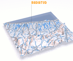 Places with similar names to Badī‘at ‘Ūd, Oman ::
// Batī Dīda (ET)
// Bodādīt (IN)
// Beït Dâoud (LB)
// Bedi Dat (PK)
// Bedi Dat (PK)
// Batatota (LK)
// Beaudéduit (FR)
// Biḩdaydāt (LB)
// Baotadadui (CN)
Disclaimer :: Information on this page comes without warranty of any kind |
||
|
Where is Badī‘at ‘Ūd? Elevation and coordinates ::
Latitude (lat): 23°49'27"N Longitude (lon): 57°30'31"E
(map arrows pan, magnifying glasses zoom) |
||
|
Visiting Badī‘at ‘Ūd? Hotel/Accommodation ::
Book a hotel in Badī‘at ‘Ūd Travel Guide ::
Buy a travel guide for Oman rental cars ::
car rental offers GPS waypoint ::
download a GPX waypoint (PoI) of Badī‘at ‘Ūd for your GPS receiver
|
||