|
search place name
|
||
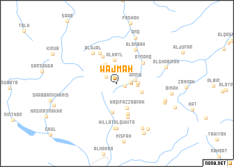
Wajmah (Oman)Wajmah is a town in Oman. An overview map of the region around Wajmah is displayed below.
regional and 3d topo map of Wajmah, Oman ::
Wajmah airports ::
The nearest airport is MCT - Muscat Seeb Intl, located 108.4 km north east of Wajmah.
Other airports nearby include FJR - Fujeirah Fujairah Intl (231.7 km north west), Nearby towns ::
Firā‘ah (1.2km east) //
Al Hūb (1.9km north west) //
Mashūq (2.2km north) //
Al Ghawr (2.0km east) //
Al Burr (2.1km east) //
An Nīd (2.8km east) //
Maqammah (3.1km north east) //
Al ‘Uqmayrah (3.1km east) //
Al Mībū (3.2km east) //
Madrūj (3.5km north west) //
Al Ḩayl (3.8km north) //
Al Ḩuwīb (3.9km east) //
Waqīf az Zabrah (4.2km south) //
Ghayl Wādī as Sayatīn (4.6km south) //
Al Ḩājir (4.8km north west) //
Al Jahlīyah (5.2km south) //
‘Ayn ‘Amq (5.1km north east) //
Mazra‘ (5.5km north west) //
Al Mazārah (5.7km south) //
Al Ambaḩ (6.0km north east) //
Al ‘Ajal (6.0km north west) //
Ḩillat al Qūwīta‘ (7.2km south) //
Jabal Qīqat as Sāfil (7.2km south) //
‘Amq (7.8km north) //
Salmah (7.6km south east) //
Bilād ‘Aqabat al Ḩamrāʼ (8.1km south east) //
Mazra‘ (7.7km east) //
Al Ghabīrah (7.7km east) //
Ḩayl Juwārī (8.6km south east) //
[all distances 'as the bird flies' and approximate]  Places with similar names to Wajmah, Oman ::
Disclaimer :: Information on this page comes without warranty of any kind |
||
|
Where is Wajmah? Elevation and coordinates ::
Latitude (lat): 23°13'22"N Longitude (lon): 57°18'10"E
Elevation (approx.): 1405m (map arrows pan, magnifying glasses zoom) |
||
|
Visiting Wajmah? Hotel/Accommodation ::
Book a hotel in Wajmah Travel Guide ::
Buy a travel guide for Oman rental cars ::
car rental offers GPS waypoint ::
download a GPX waypoint (PoI) of Wajmah for your GPS receiver
|
||