|
search place name
|
||
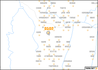
Adar (Gongola, Nigeria)Adar is a town in the Gongola region of Nigeria. An overview map of the region around Adar is displayed below.
regional and 3d topo map of Adar, Nigeria ::
Adar airports ::
The nearest airport is BPC - Bamenda, located 110.9 km south east of Adar.
Other airports nearby include MDI - Makurdi (138.7 km north west), BFX - Bafoussam (171.3 km south east), FOM - Foumban Nkounja (190.1 km south east), ENU - Enugu (221.9 km west), Nearby towns ::
Dzema (1.9km south) //
Iber (1.9km north) //
Gwe (2.6km north west) //
Pawa (2.6km north east) //
Gbaka (3.7km south) //
Kume (3.7km west) //
Jam (3.7km west) //
Baagire (4.1km south west) //
Huma (4.1km south west) //
Mande (4.1km north west) //
Kamena (4.1km south east) //
Buter (5.2km north west) //
Ibor (5.2km south east) //
Kwaghtese (5.2km north east) //
Wende (5.2km north east) //
Adee (5.6km south) //
Ikpasure (5.9km south) //
Kighir (5.9km north) //
Kpooghor (5.9km north) //
Iyortsu (5.9km north) //
Ikumber (5.8km east) //
Koboro (5.9km south) //
Gbor (5.9km north) //
Ango (6.6km south east) //
Aule (6.6km north east) //
Nudugh (6.6km north east) //
Jato Aka (6.7km north west) //
Dabuu (6.7km south east) //
Anyiman (7.4km south) //
[all distances 'as the bird flies' and approximate] 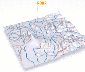 Places with similar names to Adar, Nigeria ::
Disclaimer :: Information on this page comes without warranty of any kind |
||
|
Where is Adar? Elevation and coordinates ::
Latitude (lat): 6°51'0"N Longitude (lon): 9°32'0"E
Elevation (approx.): 207m (map arrows pan, magnifying glasses zoom) |
||
|
Visiting Adar? Hotel/Accommodation ::
Book a hotel in Adar Travel Guide ::
Buy a travel guide for Nigeria rental cars ::
car rental offers GPS waypoint ::
download a GPX waypoint (PoI) of Adar for your GPS receiver
|
||