|
search place name
|
||
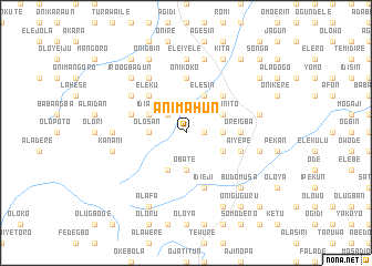
Animahun (Gongola, Nigeria)Animahun is a town in the Gongola region of Nigeria. An overview map of the region around Animahun is displayed below.
regional and 3d topo map of Animahun, Nigeria ::
Animahun airports ::
The nearest airport is ILR - Ilorin, located 32.5 km east of Animahun.
Other airports nearby include IBA - Ibadan (119.1 km south), AKR - Akure (177.4 km south east), LOS - Lagos Murtala Muhammed (225.4 km south west), Nearby towns ::
Arungbo (1.8km east) //
Alawowo (2.6km north west) //
Olosan (3.7km west) //
Jagbe (3.7km east) //
Alagbon (3.7km west) //
Araro (3.7km east) //
Obate (3.7km south) //
Aiyegun (3.7km south) //
Igbo Onito (4.1km north east) //
Idiape (4.1km north west) //
Elesin (4.1km north east) //
Agabi (4.1km south east) //
Idowu (4.1km south west) //
Gaa (4.1km south west) //
Idi Igbo (4.1km south west) //
Adafila (5.2km north east) //
Alafon (5.2km north east) //
Eleku (5.2km north west) //
Onikoko (5.6km north) //
Oreigba (5.5km east) //
Alangua (5.8km west) //
Agbanda (5.8km east) //
Aiyepe (5.8km east) //
Aro (5.9km south) //
Idi Eji (5.9km south) //
Igboayin (6.7km north west) //
Eleru (6.7km north west) //
Igboayin Dondo (6.7km north west) //
Alawodi (6.6km north west) //
[all distances 'as the bird flies' and approximate] 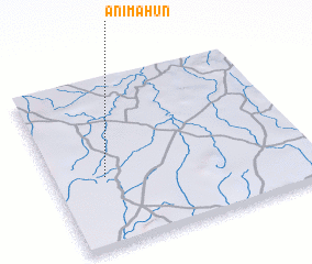 Places with similar names to Animahun, Nigeria :: Disclaimer :: Information on this page comes without warranty of any kind |
||
|
Where is Animahun? Elevation and coordinates ::
Latitude (lat): 8°25'0"N Longitude (lon): 4°12'0"E
Elevation (approx.): 361m (map arrows pan, magnifying glasses zoom) |
||
|
Visiting Animahun? Hotel/Accommodation ::
Book a hotel in Animahun Travel Guide ::
Buy a travel guide for Nigeria rental cars ::
car rental offers GPS waypoint ::
download a GPX waypoint (PoI) of Animahun for your GPS receiver
|
||