|
search place name
|
||
Apata (Gongola, Nigeria)Apata is a town in the Gongola region of Nigeria. An overview map of the region around Apata is displayed below.
regional and 3d topo map of Apata, Nigeria ::

Apata airports ::
The nearest airport is ILR - Ilorin, located 47.6 km south east of Apata.
Other airports nearby include IBA - Ibadan (159.6 km south), AKR - Akure (206.7 km south east), Nearby towns ::
Bonni (0.0km north) //
Ekule (0.0km north) //
Abemi (1.8km west) //
Babaloke (1.8km west) //
Babaloke Isiaka (1.8km west) //
Jeunkunnu (1.8km west) //
Elekoto (1.9km north) //
Alajere (2.6km south east) //
Ori Oke (2.6km north east) //
Alakara (3.7km east) //
Alaba (3.7km north) //
Elewure (4.1km south west) //
Gongonmi (4.1km south west) //
Okebode (4.1km north west) //
Olupo (4.1km north west) //
Megidaju (4.1km north west) //
Ponpola (4.1km north west) //
Onilearo (4.1km north east) //
Olowo Ori Oke (4.1km north east) //
Adikuta (5.2km south west) //
Onisunni (5.2km north west) //
Meri (5.2km north west) //
Alagbo (5.2km north west) //
Bude Titun (5.2km south east) //
Olege (5.6km north) //
Konike (5.6km north) //
Igbagun (5.5km east) //
Budo Gbemgbeleku (5.8km east) //
Gongonmi Daji (5.8km west) //
[all distances 'as the bird flies' and approximate] 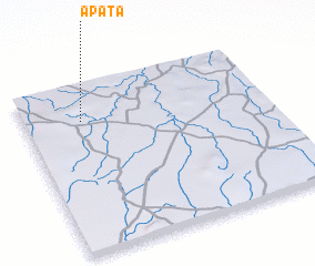 Places with similar names to Apata, Nigeria ::
Disclaimer :: Information on this page comes without warranty of any kind |
||
|
Where is Apata? Elevation and coordinates ::
Latitude (lat): 8°47'0"N Longitude (lon): 4°14'0"E
Elevation (approx.): 338m (map arrows pan, magnifying glasses zoom) |
||
|
Visiting Apata? Hotel/Accommodation ::
Book a hotel in Apata Travel Guide ::
Buy a travel guide for Nigeria rental cars ::
car rental offers GPS waypoint ::
download a GPX waypoint (PoI) of Apata for your GPS receiver
|
||