|
search place name
|
||
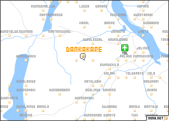
Dankakare (Gongola, Nigeria)Dankakare is a town in the Gongola region of Nigeria. An overview map of the region around Dankakare is displayed below.
regional and 3d topo map of Dankakare, Nigeria ::
Dankakare airports ::
The nearest airport is YOL - Yola, located 9.2 km east of Dankakare.
Other airports nearby include GOU - Garoua (112.7 km east), NGE - N'gaoundere Ngaoundere (246.6 km south east), MVR - Maroua Salak (248.8 km north east), Nearby towns ::
Bulamare (1.8km west) //
Tongare (1.8km east) //
Dumnga (1.8km west) //
Sabere (1.9km north) //
Wuro Leggal (4.1km north east) //
Rumnde Kila (5.8km east) //
Mayel Kohi (5.9km south) //
Gaulire (6.7km south east) //
Kalahi (6.6km south east) //
Karal (7.4km north) //
Bargare (7.3km east) //
Ngolirde (7.6km south) //
Namtari Gurel (7.8km north west) //
Rumnde Mallum (8.2km south east) //
Wauro Jabbe (8.2km north east) //
Wuro Bobbori (9.2km south west) //
Dampire (9.2km south east) //
Dolabe (9.2km north east) //
Ibarre (9.2km north east) //
Jambutu (9.2km north east) //
[all distances 'as the bird flies' and approximate] 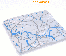 Places with similar names to Dankakare, Nigeria ::
// Tingkara (ID)
// Dan Gaguéré (NE)
// Dingkar (SD)
// Dinga Kurāi (PK)
// Dinga Kurāi (PK)
// Dankakoro (GN)
// Danka Koura (GN)
// Dongo Gure (NG)
// Dangakoro (ML)
// Dangoukoura (ML)
Disclaimer :: Information on this page comes without warranty of any kind |
||
|
Where is Dankakare? Elevation and coordinates ::
Latitude (lat): 9°14'0"N Longitude (lon): 12°21'0"E
Elevation (approx.): 221m (map arrows pan, magnifying glasses zoom) |
||
|
Visiting Dankakare? Hotel/Accommodation ::
Book a hotel in Dankakare Travel Guide ::
Buy a travel guide for Nigeria rental cars ::
car rental offers GPS waypoint ::
download a GPX waypoint (PoI) of Dankakare for your GPS receiver
|
||