|
search place name
|
||
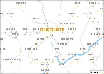
Ekurekunta (Gongola, Nigeria)Ekurekunta is a town in the Gongola region of Nigeria. An overview map of the region around Ekurekunta is displayed below.
regional and 3d topo map of Ekurekunta, Nigeria ::
Ekurekunta airports ::
The nearest airport is ENU - Enugu, located 73.0 km north west of Ekurekunta.
Other airports nearby include CBQ - Calabar (116.7 km south), PHC - Port Hartcourt Port Harcourt Intl (155.5 km south west), MDI - Makurdi (204.4 km north), TKC - Tiko (257.7 km south east), Nearby towns ::
Okpoha (1.8km west) //
Ezira (4.1km north west) //
Okpo Ezi (4.1km south west) //
Abba Omega (4.1km north east) //
Agbara Igbo (4.1km north east) //
Akpohoa Igbo (5.2km north east) //
Emin Ekpon (5.2km south east) //
Ogo Ubi (5.8km west) //
Ngarabe (5.8km east) //
Ameta (5.9km south) //
Amate Enu (5.8km west) //
Egboro Enye (5.8km east) //
Ekwere Kunta (6.7km north east) //
Ibi (6.7km south west) //
Akarafo (7.6km east) //
Amofia (7.8km north west) //
Anong (8.3km north east) //
Ozara Ukwu (9.2km south west) //
Igberi (10.5km north east) //
Eligere (10.5km south east) //
[all distances 'as the bird flies' and approximate] 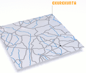 Places with similar names to Ekurekunta, Nigeria :: Disclaimer :: Information on this page comes without warranty of any kind |
||
|
Where is Ekurekunta? Elevation and coordinates ::
Latitude (lat): 5°58'0"N Longitude (lon): 7°59'0"E
Elevation (approx.): 34m (map arrows pan, magnifying glasses zoom) |
||
|
Visiting Ekurekunta? Hotel/Accommodation ::
Book a hotel in Ekurekunta Travel Guide ::
Buy a travel guide for Nigeria rental cars ::
car rental offers GPS waypoint ::
download a GPX waypoint (PoI) of Ekurekunta for your GPS receiver
|
||