|
search place name
|
||
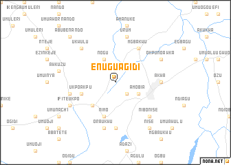
Enugu Agidi (Gongola, Nigeria)Enugu Agidi is a town in the Gongola region of Nigeria. An overview map of the region around Enugu Agidi is displayed below.
regional and 3d topo map of Enugu Agidi, Nigeria ::
Enugu Agidi airports ::
The nearest airport is ENU - Enugu, located 66.7 km north east of Enugu Agidi.
Other airports nearby include PHC - Port Hartcourt Port Harcourt Intl (133.0 km south), BNI - Benin (157.2 km west), CBQ - Calabar (201.4 km south east), AKR - Akure (221.3 km north west), Nearby towns ::
Umuokpu (2.6km south east) //
Nogu (4.1km north west) //
Amobia (4.1km south east) //
Abagana (5.2km south west) //
Nimo (5.9km south) //
Enugu Ukwu (5.9km south) //
Ukpo Akpu (5.8km west) //
Mgbakwu (6.7km north east) //
Akwa (7.4km east) //
Agukwu Nri (7.4km south) //
Urum (7.6km north) //
Oraukwu (7.6km south) //
Ifite Ukpo (7.6km west) //
Nibo Nise (7.8km south east) //
Ukwulu (7.8km north west) //
Ifite Awka (8.2km north east) //
Okpuno Awka (8.2km north east) //
Ifite Ukpo (8.2km south west) //
Nise (9.2km south east) //
Abube Nando (10.5km north west) //
[all distances 'as the bird flies' and approximate] 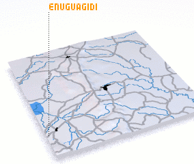 Places with similar names to Enugu Agidi, Nigeria :: Disclaimer :: Information on this page comes without warranty of any kind |
||
|
Where is Enugu Agidi? Elevation and coordinates ::
Latitude (lat): 6°13'0"N Longitude (lon): 7°1'0"E
Elevation (approx.): 108m (map arrows pan, magnifying glasses zoom) |
||
|
Visiting Enugu Agidi? Hotel/Accommodation ::
Book a hotel in Enugu Agidi Travel Guide ::
Buy a travel guide for Nigeria rental cars ::
car rental offers GPS waypoint ::
download a GPX waypoint (PoI) of Enugu Agidi for your GPS receiver
|
||