|
search place name
|
||
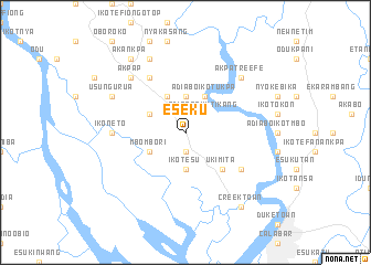
Eseku (Gongola, Nigeria)Eseku is a town in the Gongola region of Nigeria. An overview map of the region around Eseku is displayed below.
regional and 3d topo map of Eseku, Nigeria ::
Eseku airports ::
The nearest airport is CBQ - Calabar, located 15.0 km south east of Eseku.
Other airports nearby include PHC - Port Hartcourt Port Harcourt Intl (142.4 km west), SSG - Malabo (152.6 km south), TKC - Tiko (164.1 km south east), ENU - Enugu (174.2 km north west), Nearby towns ::
Ikot Obong Eno (1.9km south) //
Ukem Ikot Ekpo Ene (2.6km north west) //
Adiabo Okutikang (2.6km north east) //
Ikot Esu (3.7km south) //
Ikot Okon Abasi (3.7km north) //
Obot Eyo (4.1km north west) //
Adiabo Ikot Ukpa (4.1km north east) //
Ikot Akpana (4.1km north west) //
Mbombori (4.1km south west) //
Ukim Ita (5.2km south east) //
Afaha (6.7km north west) //
Ibonda (6.7km south east) //
Ikoneto (7.4km west) //
Akpatre Efe (7.8km north east) //
Akpap (7.8km north west) //
Usung Urua (8.3km north west) //
Ifako Okoyong (8.3km north west) //
Creek Town (9.3km south east) //
Akankpa (9.3km north west) //
[all distances 'as the bird flies' and approximate] 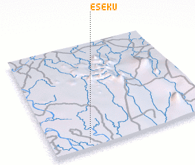 Places with similar names to Eseku, Nigeria ::
Disclaimer :: Information on this page comes without warranty of any kind |
||
|
Where is Eseku? Elevation and coordinates ::
Latitude (lat): 5°3'0"N Longitude (lon): 8°14'0"E
Elevation (approx.): 72m (map arrows pan, magnifying glasses zoom) |
||
|
Visiting Eseku? Hotel/Accommodation ::
Book a hotel in Eseku Travel Guide ::
Buy a travel guide for Nigeria rental cars ::
car rental offers GPS waypoint ::
download a GPX waypoint (PoI) of Eseku for your GPS receiver
|
||