|
search place name
|
||
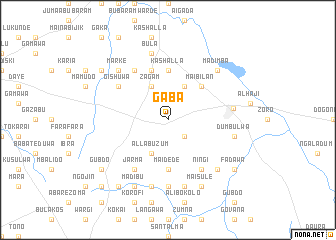
Gaba (Gongola, Nigeria)Gaba is a town in the Gongola region of Nigeria. An overview map of the region around Gaba is displayed below.
regional and 3d topo map of Gaba, Nigeria ::
Gaba airports ::
The nearest airport is MIU - Maiduguri, located 198.9 km east of Gaba.
Nearby towns ::
Garin Sarkin Janga (2.6km south east) //
Badirama (4.1km north east) //
Zagam (4.1km north west) //
Allabuzum (4.1km south west) //
Maibilan (5.2km north east) //
Kashʼalla (5.6km north) //
Maidede (5.6km south) //
Bagaji (5.6km south) //
Gabakau (5.8km north) //
Gishuwa (6.6km north west) //
Garin Maji (6.6km north west) //
Ningi (6.6km south east) //
Mallam Kule (6.6km north west) //
Jarma (6.6km south west) //
Damagum (7.2km east) //
Garin Hassan (7.4km south) //
Baba (7.6km north) //
Dumbulwa (7.5km east) //
Bula (7.6km north) //
Busamodi (7.6km south) //
Dankara (7.6km south) //
Damazai (7.6km south) //
Madimba (7.8km north east) //
Marke (7.8km north west) //
Made (7.8km north east) //
Dira (7.8km south east) //
Maisule (8.3km south east) //
Madibu (8.3km south west) //
Fadawa (9.1km south east) //
[all distances 'as the bird flies' and approximate]  Places with similar names to Gaba, Nigeria ::
Disclaimer :: Information on this page comes without warranty of any kind |
||
|
Where is Gaba? Elevation and coordinates ::
Latitude (lat): 11°40'0"N Longitude (lon): 11°16'0"E
Elevation (approx.): 440m (map arrows pan, magnifying glasses zoom) |
||
|
Visiting Gaba? Hotel/Accommodation ::
Book a hotel in Gaba Travel Guide ::
Buy a travel guide for Nigeria rental cars ::
car rental offers GPS waypoint ::
download a GPX waypoint (PoI) of Gaba for your GPS receiver
|
||