|
search place name
|
||
Gwajam Gwari (Gongola, Nigeria)Gwajam Gwari is a town in the Gongola region of Nigeria. An overview map of the region around Gwajam Gwari is displayed below.
regional and 3d topo map of Gwajam Gwari, Nigeria ::

Gwajam Gwari airports ::
The nearest airport is YOL - Yola, located 216.4 km south east of Gwajam Gwari.
Other airports nearby include MIU - Maiduguri (225.5 km north east), Nearby towns ::
Gulumari (1.9km north) //
Galgaldu (2.6km south east) //
Jalingo (3.7km north) //
Jimbam (4.1km north east) //
Mamuda (5.2km south east) //
Wuro Gwana (5.6km north) //
Garin Abba (5.6km north) //
Dingaya (6.6km south east) //
Gura Jawa (6.6km north east) //
Abba Isari (7.3km east) //
Biri Bolawa (7.4km north) //
Biri Filani (7.6km north) //
Magaba (7.5km east) //
Maiduguri (7.8km south east) //
Madakiri (8.2km north east) //
Sudingo (8.3km north east) //
Mabani (9.2km north east) //
Saleri (10.4km south east) //
Unguwar Yaiyaro (10.4km north east) //
[all distances 'as the bird flies' and approximate] 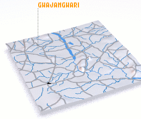 Places with similar names to Gwajam Gwari, Nigeria :: Disclaimer :: Information on this page comes without warranty of any kind |
||
|
Where is Gwajam Gwari? Elevation and coordinates ::
Latitude (lat): 10°51'0"N Longitude (lon): 11°17'0"E
Elevation (approx.): 442m (map arrows pan, magnifying glasses zoom) |
||
|
Visiting Gwajam Gwari? Hotel/Accommodation ::
Book a hotel in Gwajam Gwari Travel Guide ::
Buy a travel guide for Nigeria rental cars ::
car rental offers GPS waypoint ::
download a GPX waypoint (PoI) of Gwajam Gwari for your GPS receiver
|
||