|
search place name
|
||
Haa (Gongola, Nigeria)Haa is a town in the Gongola region of Nigeria. An overview map of the region around Haa is displayed below.
regional and 3d topo map of Haa, Nigeria ::

Haa airports ::
The nearest airport is MDI - Makurdi, located 71.1 km north of Haa.
Other airports nearby include ENU - Enugu (150.9 km south west), BPC - Bamenda (187.8 km south east), BFX - Bafoussam (243.9 km south east), FOM - Foumban Nkounja (270.1 km south east), Nearby towns ::
Ijil (0.0km north) //
Iorbee (0.0km north) //
Uba (0.0km north) //
Tarkura (1.9km south) //
Akov (1.9km south) //
Uanywe (1.8km east) //
Msaa (1.9km north) //
Lakpa (1.9km north) //
Apaa (1.9km north) //
Akuse (1.8km east) //
Agan (1.8km east) //
Tswam (1.8km east) //
Amen (1.8km east) //
Deede (1.8km east) //
Wasem (2.6km south west) //
Atule (2.6km south east) //
Uantyondu (2.6km south east) //
Tiem (2.6km south east) //
Kpalev (2.6km south east) //
Hiogu (2.6km south east) //
Kyobo (2.6km north east) //
Mshi (2.6km north east) //
Lium (2.6km north east) //
Tiem (2.6km north east) //
Nyichie (2.6km north east) //
Anar (2.6km north east) //
Iorapuu (2.6km north east) //
Agelaga (2.6km north east) //
Nyolum (2.6km north east) //
[all distances 'as the bird flies' and approximate] 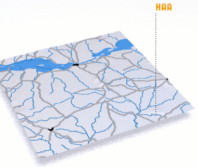 Places with similar names to Haa, Nigeria ::
Disclaimer :: Information on this page comes without warranty of any kind |
||
|
Where is Haa? Elevation and coordinates ::
Latitude (lat): 7°5'0"N Longitude (lon): 8°47'0"E
Elevation (approx.): 156m (map arrows pan, magnifying glasses zoom) |
||
|
Visiting Haa? Hotel/Accommodation ::
Book a hotel in Haa Travel Guide ::
Buy a travel guide for Nigeria rental cars ::
car rental offers GPS waypoint ::
download a GPX waypoint (PoI) of Haa for your GPS receiver
|
||