|
search place name
|
||
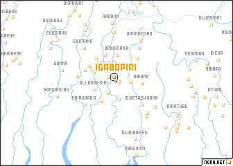
Igabopiri (Gongola, Nigeria)Igabopiri is a town in the Gongola region of Nigeria. An overview map of the region around Igabopiri is displayed below.
regional and 3d topo map of Igabopiri, Nigeria ::
Igabopiri airports ::
The nearest airport is PHC - Port Hartcourt Port Harcourt Intl, located 84.4 km north east of Igabopiri.
Other airports nearby include BNI - Benin (205.9 km north), ENU - Enugu (249.4 km north east), Nearby towns ::
Keminini (0.5km north east) //
Burukiri (1.6km north west) //
Basuokiri (2.1km south west) //
Fatumakiri (2.1km south west) //
Sabatoru (2.3km east) //
Kukukiri (2.5km north west) //
Okokokiri (2.7km south) //
Allagoakiri (3.7km west) //
Tengikiri (3.7km south west) //
Ewokiri (4.1km north west) //
Obiama (4.2km east) //
Ologoama (4.4km north west) //
Oruweiama (4.5km north) //
Ekperikiri (4.9km north) //
Akakumama (5.1km north west) //
Akipelai (5.1km north east) //
Iwoama (5.2km north west) //
Igbeta Ewoama (5.4km south east) //
Ewokiri (5.4km south east) //
Aburukiri (5.5km west) //
Mbiakpaba (6.2km south west) //
Sounkiri (6.4km west) //
Awiakalakala (6.7km north east) //
Onunama (7.0km south east) //
Agakabiriyai (7.2km south east) //
Etiema (7.3km south east) //
Eminiama (7.6km north west) //
Opomatobo (7.9km north east) //
Oloibiri (8.2km north) //
[all distances 'as the bird flies' and approximate] 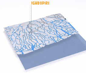 Places with similar names to Igabopiri, Nigeria ::
// Iākubpur (BD)
Disclaimer :: Information on this page comes without warranty of any kind |
||
|
Where is Igabopiri? Elevation and coordinates ::
Latitude (lat): 4°35'53"N Longitude (lon): 6°18'45"E
Elevation (approx.): 7m (map arrows pan, magnifying glasses zoom) |
||
|
Visiting Igabopiri? Hotel/Accommodation ::
Book a hotel in Igabopiri Travel Guide ::
Buy a travel guide for Nigeria rental cars ::
car rental offers GPS waypoint ::
download a GPX waypoint (PoI) of Igabopiri for your GPS receiver
|
||