|
search place name
|
||
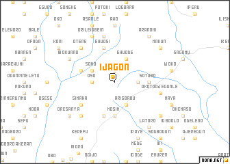
Ijagon (Gongola, Nigeria)Ijagon is a town in the Gongola region of Nigeria. An overview map of the region around Ijagon is displayed below.
regional and 3d topo map of Ijagon, Nigeria ::
Ijagon airports ::
The nearest airport is LOS - Lagos Murtala Muhammed, located 36.6 km south west of Ijagon.
Other airports nearby include IBA - Ibadan (76.7 km north east), COO - Cotonou Cadjehoun (138.6 km west), AKR - Akure (199.2 km east), ILR - Ilorin (207.6 km north east), Nearby towns ::
Otunbakoga (1.9km north) //
Oke Ate (1.9km north) //
Oso (3.7km west) //
Erugbin (3.7km east) //
Somo (4.1km north west) //
Ewu Ode (4.1km north east) //
Arigbabu (4.1km south east) //
Mosīm (5.6km south) //
Sotubo (5.5km east) //
Ewu Ogun (5.8km west) //
Ewu Osi (5.9km north) //
Likosi (5.9km south) //
Simawa (6.6km south west) //
Isoku (7.6km north) //
Okoto Ajegunle (7.6km east) //
Otere (7.8km north west) //
Ipa (7.8km south west) //
Orile Igbein (8.3km north west) //
Iboku Aro (8.2km north west) //
Araromi (9.2km north east) //
Oresanya (9.2km south west) //
Latoro (9.2km south east) //
Oke Akuko (9.2km south east) //
Makun (9.2km north east) //
[all distances 'as the bird flies' and approximate]  Places with similar names to Ijagon, Nigeria ::
Disclaimer :: Information on this page comes without warranty of any kind |
||
|
Where is Ijagon? Elevation and coordinates ::
Latitude (lat): 6°49'0"N Longitude (lon): 3°33'0"E
Elevation (approx.): 63m (map arrows pan, magnifying glasses zoom) |
||
|
Visiting Ijagon? Hotel/Accommodation ::
Book a hotel in Ijagon Travel Guide ::
Buy a travel guide for Nigeria rental cars ::
car rental offers GPS waypoint ::
download a GPX waypoint (PoI) of Ijagon for your GPS receiver
|
||