|
search place name
|
||
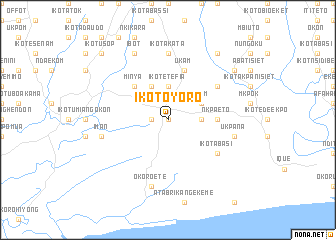
Ikot Oyoro (Gongola, Nigeria)Ikot Oyoro is a town in the Gongola region of Nigeria. An overview map of the region around Ikot Oyoro is displayed below.
regional and 3d topo map of Ikot Oyoro, Nigeria ::
Ikot Oyoro airports ::
The nearest airport is CBQ - Calabar, located 75.7 km north east of Ikot Oyoro.
Other airports nearby include PHC - Port Hartcourt Port Harcourt Intl (100.8 km north west), SSG - Malabo (141.5 km south east), TKC - Tiko (186.3 km east), ENU - Enugu (206.7 km north), Nearby towns ::
Ekim (0.0km north) //
Ikot Obio Ndoghe (1.8km west) //
Ibotio (3.7km east) //
Ikot Uqua (3.7km north) //
Ikot Etefia (3.7km north) //
Okom (4.1km north east) //
Ikot Udo (4.1km north west) //
Minya (5.2km north west) //
Nkpa Eto (5.5km east) //
Ukam (5.9km north) //
Asong (6.7km north east) //
Ikot Abasi (6.7km south east) //
Ikot Akata (7.4km north) //
Ukpana (7.6km east) //
Iman (7.6km west) //
Okoro Ete (7.6km south) //
Ibot (8.3km north west) //
Afaha (9.2km north east) //
Awa (9.2km north east) //
Ikot Idem Udo (9.3km north east) //
Afaha Atai (9.3km north east) //
Ikot Usop (10.5km north west) //
[all distances 'as the bird flies' and approximate] 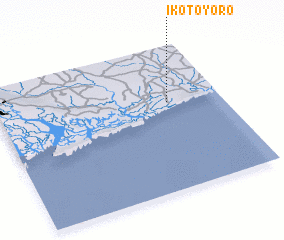 Places with similar names to Ikot Oyoro, Nigeria ::
// Ikot Iyire (NG)
Disclaimer :: Information on this page comes without warranty of any kind |
||
|
Where is Ikot Oyoro? Elevation and coordinates ::
Latitude (lat): 4°37'0"N Longitude (lon): 7°46'0"E
Elevation (approx.): 18m (map arrows pan, magnifying glasses zoom) |
||
|
Visiting Ikot Oyoro? Hotel/Accommodation ::
Book a hotel in Ikot Oyoro Travel Guide ::
Buy a travel guide for Nigeria rental cars ::
car rental offers GPS waypoint ::
download a GPX waypoint (PoI) of Ikot Oyoro for your GPS receiver
|
||