|
search place name
|
||
Ipari Isale (Gongola, Nigeria)Ipari Isale is a town in the Gongola region of Nigeria. An overview map of the region around Ipari Isale is displayed below.
regional and 3d topo map of Ipari Isale, Nigeria ::

Ipari Isale airports ::
The nearest airport is IBA - Ibadan, located 51.1 km north of Ipari Isale.
Other airports nearby include LOS - Lagos Murtala Muhammed (81.4 km south west), AKR - Akure (150.5 km east), ILR - Ilorin (179.4 km north), COO - Cotonou Cadjehoun (186.7 km west), Nearby towns ::
Ipari Oke (0.0km north) //
Imope (1.8km west) //
Aparaki (1.9km north) //
Iganran (4.1km north west) //
Oke Eri (5.2km south west) //
Agunboye Imoru (5.2km north east) //
Agunboye (5.5km north east) //
Onosenlu Alako (5.9km south) //
Oru (6.7km north west) //
Ogbogbo (6.7km south west) //
Isonyin (7.4km south) //
Erunwon (7.6km south) //
Odosimadegun (7.6km east) //
Ijebu Igbo (7.6km north) //
Awa (7.8km north west) //
Odoyanta (8.2km south west) //
Eri Oburo (8.2km south east) //
Ago Iwoye (9.2km north west) //
[all distances 'as the bird flies' and approximate] 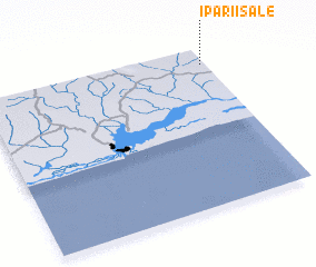 Places with similar names to Ipari Isale, Nigeria :: Disclaimer :: Information on this page comes without warranty of any kind |
||
|
Where is Ipari Isale? Elevation and coordinates ::
Latitude (lat): 6°54'0"N Longitude (lon): 3°59'0"E
Elevation (approx.): 81m (map arrows pan, magnifying glasses zoom) |
||
|
Visiting Ipari Isale? Hotel/Accommodation ::
Book a hotel in Ipari Isale Travel Guide ::
Buy a travel guide for Nigeria rental cars ::
car rental offers GPS waypoint ::
download a GPX waypoint (PoI) of Ipari Isale for your GPS receiver
|
||