|
search place name
|
||
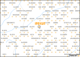
Ipekun (Gongola, Nigeria)Ipekun is a town in the Gongola region of Nigeria. An overview map of the region around Ipekun is displayed below.
regional and 3d topo map of Ipekun, Nigeria ::
Ipekun airports ::
The nearest airport is ILR - Ilorin, located 21.1 km north east of Ipekun.
Other airports nearby include IBA - Ibadan (117.2 km south), AKR - Akure (164.7 km south east), LOS - Lagos Murtala Muhammed (226.3 km south west), Nearby towns ::
Ode (1.9km north) //
Olokun (1.9km south) //
Olowo (1.9km south) //
Elere (2.6km south east) //
Ajamagba (2.6km south west) //
Elekulu (3.7km north) //
Isepo (3.7km south) //
Oloya (3.7km west) //
Ogidi (3.7km south) //
Elebe (4.1km north east) //
Olugban (4.1km south east) //
Alaja (4.1km south east) //
Owode (5.2km north east) //
Alata (5.2km north east) //
Yakoyo (5.2km south east) //
Igbo Edu (5.2km north west) //
Arowomokun (5.2km north west) //
Pekan (5.2km north west) //
Ketu (5.2km south west) //
Sata (5.5km east) //
Taruwa (5.9km south) //
Jato (5.9km south) //
Aiyekale (5.9km south) //
Agbege (5.9km north) //
Apo (5.9km north) //
Arowosaiye (5.9km south) //
Ajegunle (5.9km south) //
Alasiri (5.9km south) //
Omidoyin (5.8km west) //
[all distances 'as the bird flies' and approximate] 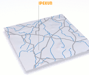
Disclaimer :: Information on this page comes without warranty of any kind |
||
|
Where is Ipekun? Elevation and coordinates ::
Latitude (lat): 8°22'0"N Longitude (lon): 4°19'0"E
Elevation (approx.): 373m (map arrows pan, magnifying glasses zoom) |
||
|
Visiting Ipekun? Hotel/Accommodation ::
Book a hotel in Ipekun Travel Guide ::
Buy a travel guide for Nigeria rental cars ::
car rental offers GPS waypoint ::
download a GPX waypoint (PoI) of Ipekun for your GPS receiver
|
||