|
search place name
|
||
Jirhemba (Gongola, Nigeria)Jirhemba is a town in the Gongola region of Nigeria. An overview map of the region around Jirhemba is displayed below.
regional and 3d topo map of Jirhemba, Nigeria ::

Jirhemba airports ::
The nearest airport is BPC - Bamenda, located 147.0 km south of Jirhemba.
Other airports nearby include MDI - Makurdi (162.8 km west), BFX - Bafoussam (205.1 km south), FOM - Foumban Nkounja (206.4 km south), Nearby towns ::
Isa (0.0km north) //
Aondokpa (1.8km east) //
Atsor (1.8km east) //
Ande (2.6km north east) //
Anwen (2.6km south west) //
Kuu (2.6km south west) //
Anhwange (2.6km south east) //
Boyi (2.6km south west) //
Uhembe (3.7km west) //
Awuhe (4.1km north west) //
Nbaume (4.1km north east) //
Usuman (4.1km south west) //
Tame (4.1km south east) //
Nomso (4.1km south west) //
Garba (4.1km south east) //
Ilike (4.1km south west) //
Waniho (5.2km north west) //
Yumga (5.2km north west) //
Nomhwange (5.2km south east) //
Jimen (5.6km north) //
Naka (5.5km west) //
Adagba (5.6km north) //
Kumbur (5.8km west) //
Agema (5.9km north) //
Atitse (5.9km north) //
Saa (6.7km south east) //
Che Adekae (6.7km north east) //
Maluanti (6.7km north west) //
Ange (6.6km north west) //
[all distances 'as the bird flies' and approximate] 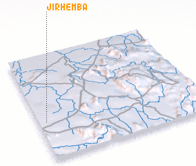 Places with similar names to Jirhemba, Nigeria ::
// Jaruhuma (BO)
Disclaimer :: Information on this page comes without warranty of any kind |
||
|
Where is Jirhemba? Elevation and coordinates ::
Latitude (lat): 7°22'0"N Longitude (lon): 10°3'0"E
Elevation (approx.): 220m (map arrows pan, magnifying glasses zoom) |
||
|
Visiting Jirhemba? Hotel/Accommodation ::
Book a hotel in Jirhemba Travel Guide ::
Buy a travel guide for Nigeria rental cars ::
car rental offers GPS waypoint ::
download a GPX waypoint (PoI) of Jirhemba for your GPS receiver
|
||