|
search place name
|
||
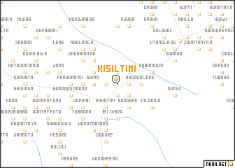
Kisiltimi (Gongola, Nigeria)Kisiltimi is a town in the Gongola region of Nigeria. An overview map of the region around Kisiltimi is displayed below.
regional and 3d topo map of Kisiltimi, Nigeria ::
Kisiltimi airports ::
The nearest airport is YOL - Yola, located 96.2 km south of Kisiltimi.
Other airports nearby include GOU - Garoua (115.7 km south east), MVR - Maroua Salak (180.3 km east), MIU - Maiduguri (199.8 km north), Nearby towns ::
Pupalti (1.9km south) //
Salasa (1.8km east) //
Mijiwana (1.8km east) //
Wuro Yaji (1.8km east) //
Wungala (1.9km south) //
Kangurungu (1.8km west) //
Amkilange (1.9km north) //
Mihawin (2.6km south east) //
Gurzhin (2.6km north east) //
Shirwun (2.6km south east) //
Wuro Golare (3.6km east) //
Shima (3.6km west) //
Karambeta (4.1km south east) //
Kisirtimi (4.1km south west) //
Sangere (4.1km south east) //
Kaudi (4.1km north west) //
Kiri (5.2km north west) //
Dibra (5.6km south) //
Gurum (5.5km west) //
Kamda (5.5km west) //
Sabongari (5.8km east) //
Ibi (5.9km south) //
Kila Kila (6.6km south east) //
Sabongida Jabare (6.6km south west) //
Wuro Ibi (6.6km south west) //
Kulara (6.7km north west) //
Dibra (6.6km north west) //
Kaudi Boima (6.7km north west) //
Ukushiwura (6.6km north west) //
[all distances 'as the bird flies' and approximate]  Places with similar names to Kisiltimi, Nigeria ::
Disclaimer :: Information on this page comes without warranty of any kind |
||
|
Where is Kisiltimi? Elevation and coordinates ::
Latitude (lat): 10°6'0"N Longitude (lon): 12°39'0"E
Elevation (approx.): 534m (map arrows pan, magnifying glasses zoom) |
||
|
Visiting Kisiltimi? Hotel/Accommodation ::
Book a hotel in Kisiltimi Travel Guide ::
Buy a travel guide for Nigeria rental cars ::
car rental offers GPS waypoint ::
download a GPX waypoint (PoI) of Kisiltimi for your GPS receiver
|
||