|
search place name
|
||
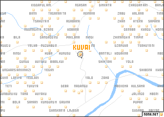
Kuvai (Gongola, Nigeria)Kuvai is a town in the Gongola region of Nigeria. An overview map of the region around Kuvai is displayed below.
regional and 3d topo map of Kuvai, Nigeria ::
Kuvai airports ::
The nearest airport is YOL - Yola, located 129.2 km south of Kuvai.
Other airports nearby include GOU - Garoua (175.5 km south east), MIU - Maiduguri (188.5 km north east), Nearby towns ::
Pirkisu (1.9km north) //
Posura (2.6km north east) //
Humusu (3.6km west) //
Paklama (4.1km north west) //
Mindi (4.1km north east) //
Bantali (5.5km east) //
Samunaka (5.9km north) //
Wobara (5.9km north) //
Jara (5.8km west) //
Bibalkui (5.8km west) //
Kidan (5.8km west) //
Yalo (5.9km south) //
Shimtami (5.8km east) //
Riba (5.8km east) //
Digira (6.6km north west) //
Laksheri (6.6km north east) //
Labu (6.6km south east) //
Huba (7.3km west) //
Gurudindin (7.4km south) //
Kutembeya (7.3km east) //
Gorogayi (7.4km south) //
Nadangu (7.4km south) //
Bwalokoja (7.5km west) //
Gunbir (7.5km west) //
Ndarabgi (7.5km west) //
Puzumbur (7.5km west) //
Agabara (7.6km north) //
Katsina (7.6km north) //
Digra (7.6km south) //
[all distances 'as the bird flies' and approximate]  Places with similar names to Kuvai, Nigeria ::
Disclaimer :: Information on this page comes without warranty of any kind |
||
|
Where is Kuvai? Elevation and coordinates ::
Latitude (lat): 10°24'0"N Longitude (lon): 12°11'0"E
Elevation (approx.): 534m (map arrows pan, magnifying glasses zoom) |
||
|
Visiting Kuvai? Hotel/Accommodation ::
Book a hotel in Kuvai Travel Guide ::
Buy a travel guide for Nigeria rental cars ::
car rental offers GPS waypoint ::
download a GPX waypoint (PoI) of Kuvai for your GPS receiver
|
||