|
search place name
|
||
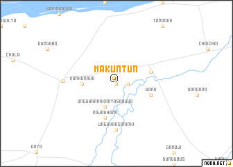
Makuntun (Gongola, Nigeria)Makuntun is a town in the Gongola region of Nigeria. An overview map of the region around Makuntun is displayed below.
regional and 3d topo map of Makuntun, Nigeria ::
Makuntun airports ::
The nearest airport is KAN - Kano Mallam Aminu Intl, located 65.1 km west of Makuntun.
Other airports nearby include ZAR - Zaria (181.4 km south west), ZND - Zinder (201.0 km north), KAD - Kaduna (241.3 km south west), MFG - Maradi (274.9 km north west), Nearby towns ::
Kirara (0.0km north) //
Digawa (0.0km north) //
Kyaberi (0.0km north) //
Sabaru (0.0km north) //
Gafasa (1.8km east) //
Unguwar Makarya Sabuwa (4.1km south west) //
Kunkurawa (5.4km west) //
Kafin Karya (5.7km east) //
Rajau Hairi (5.8km south) //
Dara (5.7km east) //
Unguwar Ganinki (7.4km south) //
Ajingi (8.4km west) //
[all distances 'as the bird flies' and approximate] 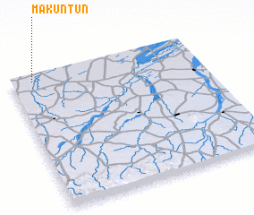 Places with similar names to Makuntun, Nigeria ::
Disclaimer :: Information on this page comes without warranty of any kind |
||
|
Where is Makuntun? Elevation and coordinates ::
Latitude (lat): 11°58'0"N Longitude (lon): 9°7'0"E
Elevation (approx.): 402m (map arrows pan, magnifying glasses zoom) |
||
|
Visiting Makuntun? Hotel/Accommodation ::
Book a hotel in Makuntun Travel Guide ::
Buy a travel guide for Nigeria rental cars ::
car rental offers GPS waypoint ::
download a GPX waypoint (PoI) of Makuntun for your GPS receiver
|
||