|
search place name
|
||
Mbowa Kura (Gongola, Nigeria)Mbowa Kura is a town in the Gongola region of Nigeria. An overview map of the region around Mbowa Kura is displayed below.
regional and 3d topo map of Mbowa Kura, Nigeria ::

Mbowa Kura airports ::
The nearest airport is MIU - Maiduguri, located 105.3 km north of Mbowa Kura.
Other airports nearby include MVR - Maroua Salak (170.4 km east), GOU - Garoua (189.8 km south), YOL - Yola (191.2 km south), Nearby towns ::
Mbowa Bulatal (2.6km south west) //
Mbowa Paiyagarga (2.6km south west) //
Mbowa Murigangaran (2.6km north west) //
Mbowa Imburbura (3.7km south) //
Wovi (3.7km north) //
Bahijan (4.1km north east) //
Bilakirde (4.1km north east) //
Kobul Hamlets (5.9km south) //
Abantagari (5.8km east) //
Tabang (5.8km west) //
Balajan (7.4km south) //
Balajan Bula Kabu (7.4km south) //
Imirfaya Bulagole (7.5km west) //
Koda Hamlets (7.6km south) //
Gombi (7.6km north) //
Abodari (7.8km north east) //
Koda Hamlets (8.3km south east) //
Yarchida (9.2km south west) //
Piying Hamlets (9.2km south east) //
[all distances 'as the bird flies' and approximate] 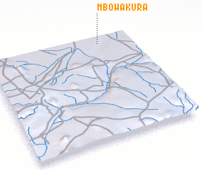
Disclaimer :: Information on this page comes without warranty of any kind |
||
|
Where is Mbowa Kura? Elevation and coordinates ::
Latitude (lat): 10°57'0"N Longitude (lon): 12°47'0"E
Elevation (approx.): 469m (map arrows pan, magnifying glasses zoom) |
||
|
Visiting Mbowa Kura? Hotel/Accommodation ::
Book a hotel in Mbowa Kura Travel Guide ::
Buy a travel guide for Nigeria rental cars ::
car rental offers GPS waypoint ::
download a GPX waypoint (PoI) of Mbowa Kura for your GPS receiver
|
||