|
search place name
|
||
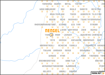
Nengel (Gongola, Nigeria)Nengel is a town in the Gongola region of Nigeria. An overview map of the region around Nengel is displayed below.
regional and 3d topo map of Nengel, Nigeria ::
Nengel airports ::
The nearest airport is MDI - Makurdi, located 63.7 km north of Nengel.
Other airports nearby include ENU - Enugu (129.8 km south west), BPC - Bamenda (213.4 km south east), ABV - Abuja Nnamdi Azikiwe Intl (250.1 km north west), BFX - Bafoussam (267.9 km south east), Nearby towns ::
Amemga (0.0km north) //
Uze (1.8km west) //
Yiwa (1.8km west) //
Tyough (1.8km west) //
Velnumbe (1.8km west) //
Toguaza (1.8km west) //
Tyor (1.8km west) //
Gbadama (1.9km south) //
Yoyo (1.9km south) //
Poor (1.8km east) //
Tahamba (1.8km east) //
Ayem (1.8km east) //
Uchuwe (1.9km north) //
Huaka (1.9km north) //
Agenor (1.8km east) //
Aliya (1.8km east) //
Akongu (1.9km north) //
Asawe (2.6km south west) //
Kaweko (2.6km north west) //
Anye (2.6km south east) //
Hikyaa (2.6km south east) //
Akov (2.6km north west) //
Nwave (2.6km north west) //
Tseaolihar (2.6km south east) //
Iokumbar (2.6km north east) //
Tayueh Sawaa (2.6km north east) //
Tokuor (2.6km north east) //
Gor (3.7km south) //
Toho (3.7km south) //
[all distances 'as the bird flies' and approximate]  Places with similar names to Nengel, Nigeria ::
Disclaimer :: Information on this page comes without warranty of any kind |
||
|
Where is Nengel? Elevation and coordinates ::
Latitude (lat): 7°8'0"N Longitude (lon): 8°32'0"E
Elevation (approx.): 126m (map arrows pan, magnifying glasses zoom) |
||
|
Visiting Nengel? Hotel/Accommodation ::
Book a hotel in Nengel Travel Guide ::
Buy a travel guide for Nigeria rental cars ::
car rental offers GPS waypoint ::
download a GPX waypoint (PoI) of Nengel for your GPS receiver
|
||