|
search place name
|
||
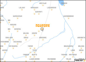
Ngurore (Gongola, Nigeria)Ngurore is a town in the Gongola region of Nigeria. An overview map of the region around Ngurore is displayed below.
regional and 3d topo map of Ngurore, Nigeria ::
Ngurore airports ::
The nearest airport is YOL - Yola, located 38.1 km north west of Ngurore.
Other airports nearby include GOU - Garoua (92.3 km north east), NGE - N'gaoundere Ngaoundere (206.1 km south east), MVR - Maroua Salak (243.7 km north east), Nearby towns ::
Wutire (1.8km west) //
Wuromanti (1.8km west) //
Tapare (1.8km west) //
Bargare (3.7km south) //
Gogra (4.1km south west) //
Guri Nati (7.6km north) //
Daladi (7.6km west) //
Chejipa (7.6km west) //
Dorodi (8.3km north west) //
Toza (8.3km south west) //
Bongladi (8.2km south west) //
Sakdi (8.2km south west) //
Yapar (9.2km south west) //
[all distances 'as the bird flies' and approximate]  Places with similar names to Ngurore, Nigeria ::
Disclaimer :: Information on this page comes without warranty of any kind |
||
|
Where is Ngurore? Elevation and coordinates ::
Latitude (lat): 8°58'0"N Longitude (lon): 12°37'0"E
Elevation (approx.): 247m (map arrows pan, magnifying glasses zoom) |
||
|
Visiting Ngurore? Hotel/Accommodation ::
Book a hotel in Ngurore Travel Guide ::
Buy a travel guide for Nigeria rental cars ::
car rental offers GPS waypoint ::
download a GPX waypoint (PoI) of Ngurore for your GPS receiver
|
||