|
search place name
|
||
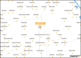
Nkwebi (Gongola, Nigeria)Nkwebi is a town in the Gongola region of Nigeria. An overview map of the region around Nkwebi is displayed below.
regional and 3d topo map of Nkwebi, Nigeria ::
Nkwebi airports ::
The nearest airport is ENU - Enugu, located 91.4 km north of Nkwebi.
Other airports nearby include CBQ - Calabar (99.0 km south east), PHC - Port Hartcourt Port Harcourt Intl (119.7 km south west), SSG - Malabo (235.8 km south east), TKC - Tiko (247.1 km south east), Nearby towns ::
Okagwe (0.0km north) //
Ndi Uduma Ukwu (3.7km south) //
Elu (5.2km south east) //
Ogo Ubi (5.9km north) //
Ebem (6.7km south east) //
Oboro (6.7km south west) //
Ohafia Ifigh (7.4km south) //
Amanta (7.4km west) //
Ihenta (7.6km south) //
Ama Ngwu (7.6km east) //
Abiriba (7.6km west) //
Ama Uke (7.8km south east) //
Ohafia (8.3km south east) //
Ogo Ubi (8.3km south west) //
Ama Uru (9.3km south west) //
Ameke Abiriba (9.2km north west) //
Ekoli (9.2km north east) //
Letu (9.2km north east) //
Asaga (10.5km south east) //
[all distances 'as the bird flies' and approximate] 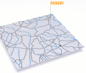
Disclaimer :: Information on this page comes without warranty of any kind |
||
|
Where is Nkwebi? Elevation and coordinates ::
Latitude (lat): 5°41'0"N Longitude (lon): 7°48'0"E
Elevation (approx.): 126m (map arrows pan, magnifying glasses zoom) |
||
|
Visiting Nkwebi? Hotel/Accommodation ::
Book a hotel in Nkwebi Travel Guide ::
Buy a travel guide for Nigeria rental cars ::
car rental offers GPS waypoint ::
download a GPX waypoint (PoI) of Nkwebi for your GPS receiver
|
||