|
search place name
|
||
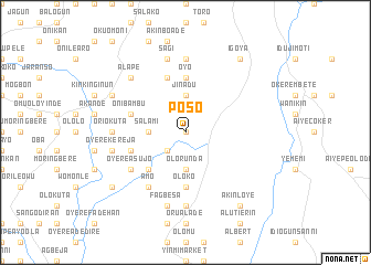
Poso (Gongola, Nigeria)Poso is a town in the Gongola region of Nigeria. An overview map of the region around Poso is displayed below.
regional and 3d topo map of Poso, Nigeria ::
Poso airports ::
The nearest airport is IBA - Ibadan, located 56.2 km west of Poso.
Other airports nearby include AKR - Akure (90.5 km east), ILR - Ilorin (126.1 km north), LOS - Lagos Murtala Muhammed (151.3 km south west), BNI - Benin (164.4 km south east), Nearby towns ::
Afolabi (0.0km north) //
Amukegun Modakeke (2.6km south west) //
Amukegun Ibadan (2.6km south west) //
Ogunsipe (3.7km south) //
Jinadu (3.7km north) //
Agbeke (3.7km north) //
Olorunda (3.7km south) //
Salami (3.7km west) //
Apamu Ife (3.7km west) //
Bolorunduro (3.7km south) //
Atowo (5.2km south west) //
Oyo (5.6km north) //
Alapata (5.6km north) //
Oloko (5.6km south) //
Awuro Oyo I (5.9km north) //
Onibambu (5.8km west) //
Idita (5.8km west) //
Kilibi (5.8km west) //
Odeosun (5.8km west) //
Amo (6.7km south west) //
Agboro (6.6km south west) //
Oyere Asujo (6.6km south west) //
Oriokuta (7.4km west) //
Ejesi II (7.4km north) //
Alabakan Amututu (7.4km south) //
Oyere Kereja (7.6km west) //
Fagbesa (7.6km south) //
Sagi (7.6km north) //
Alape (7.8km north west) //
[all distances 'as the bird flies' and approximate]  Places with similar names to Poso, Nigeria ::
Disclaimer :: Information on this page comes without warranty of any kind |
||
|
Where is Poso? Elevation and coordinates ::
Latitude (lat): 7°18'0"N Longitude (lon): 4°29'0"E
Elevation (approx.): 216m (map arrows pan, magnifying glasses zoom) |
||
|
Visiting Poso? Hotel/Accommodation ::
Book a hotel in Poso Travel Guide ::
Buy a travel guide for Nigeria rental cars ::
car rental offers GPS waypoint ::
download a GPX waypoint (PoI) of Poso for your GPS receiver
|
||