|
search place name
|
||
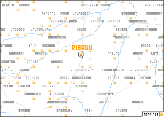
Ribadu (Gongola, Nigeria)Ribadu is a town in the Gongola region of Nigeria. An overview map of the region around Ribadu is displayed below.
regional and 3d topo map of Ribadu, Nigeria ::
Ribadu airports ::
The nearest airport is YOL - Yola, located 83.1 km north east of Ribadu.
Other airports nearby include GOU - Garoua (160.4 km north east), NGE - N'gaoundere Ngaoundere (206.4 km south east), Nearby towns ::
Pirohi (1.9km north) //
Sabon Gari (1.9km south) //
Wuro Yoro (1.8km east) //
Wuroji (2.6km north east) //
Lamsel (2.6km south east) //
Nyibango Keremi (3.7km south) //
Gangsaka (3.7km south) //
Wuro Daudu (4.1km north west) //
Maidugu (4.1km north west) //
Jaranda (4.1km north west) //
Dimkusu Dumku (4.1km south west) //
Nyibango (4.1km south west) //
Abdu (5.6km north) //
Mayo Mukan (5.6km north) //
Youro (5.6km north) //
Gangkobeni (5.6km south) //
Madugu (5.8km west) //
Gangjamare (5.9km south) //
Konreta (5.9km north) //
Danaba (5.8km west) //
Wuro Umaru (6.6km north west) //
Wuro Jato (6.6km north west) //
Nadeu (6.7km south west) //
Nabung (7.3km east) //
Timpina (7.4km south) //
Gangwa (7.6km west) //
Nakoshi (7.6km west) //
Boro (7.6km north) //
Dimeso (7.8km north west) //
[all distances 'as the bird flies' and approximate] 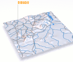 Places with similar names to Ribadu, Nigeria ::
Disclaimer :: Information on this page comes without warranty of any kind |
||
|
Where is Ribadu? Elevation and coordinates ::
Latitude (lat): 8°34'0"N Longitude (lon): 12°8'0"E
Elevation (approx.): 445m (map arrows pan, magnifying glasses zoom) |
||
|
Visiting Ribadu? Hotel/Accommodation ::
Book a hotel in Ribadu Travel Guide ::
Buy a travel guide for Nigeria rental cars ::
car rental offers GPS waypoint ::
download a GPX waypoint (PoI) of Ribadu for your GPS receiver
|
||