|
search place name
|
||
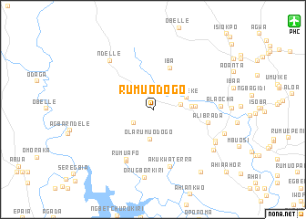
Rumuodogo (Nigeria)Rumuodogo is a town in Nigeria. An overview map of the region around Rumuodogo is displayed below.
regional and 3d topo map of Rumuodogo, Nigeria ::
Rumuodogo airports ::
The nearest airport is PHC - Port Hartcourt Port Harcourt Intl, located 20.4 km north east of Rumuodogo.
Other airports nearby include CBQ - Calabar (172.5 km east), ENU - Enugu (191.9 km north east), BNI - Benin (203.5 km north west), SSG - Malabo (248.5 km south east), Nearby towns ::
Rumuji (2.9km north west) //
Rumuafo (2.9km south west) //
Obogo (3.1km north west) //
Obaku (3.4km east) //
Ola-Rumuodogo (3.6km south) //
Ahia Eke (4.2km east) //
Oduoha (4.8km east) //
Obitie (5.2km east) //
Iba (5.6km north east) //
Rumuafo (6.9km south west) //
Alibrada (7.0km east) //
Osogu (7.1km south west) //
Akukwaterra (7.2km south) //
Ndelle (7.9km north west) //
Alaocha (8.3km east) //
Orugborkiri (8.4km south) //
Emohua (8.4km south east) //
Rumakunde (8.6km south east) //
Rumuchie (8.8km south east) //
Isiodu (9.1km east) //
Ogbamafa (9.7km south east) //
[all distances 'as the bird flies' and approximate] 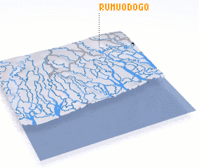 Places with similar names to Rumuodogo, Nigeria ::
// Rumah Dugu (MY)
// Rumah Tukau (MY)
// Rāmbādak (BD)
// Ramedega (IN)
// Rāmtek (IN)
// Rāmtek (IN)
// Rumahtiga (ID)
// Remidgai (SD)
Disclaimer :: Information on this page comes without warranty of any kind |
||
|
Where is Rumuodogo? Elevation and coordinates ::
Latitude (lat): 4°55'8"N Longitude (lon): 6°47'36"E
Elevation (approx.): 12m (map arrows pan, magnifying glasses zoom) |
||
|
Visiting Rumuodogo? Hotel/Accommodation ::
Book a hotel in Rumuodogo Travel Guide ::
Buy a travel guide for Nigeria rental cars ::
car rental offers GPS waypoint ::
download a GPX waypoint (PoI) of Rumuodogo for your GPS receiver
|
||