|
search place name
|
||
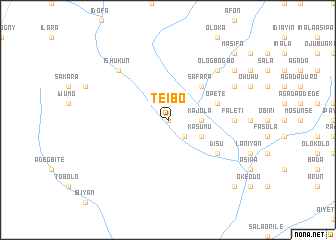
Teibo (Gongola, Nigeria)Teibo is a town in the Gongola region of Nigeria. An overview map of the region around Teibo is displayed below.
regional and 3d topo map of Teibo, Nigeria ::
Teibo airports ::
The nearest airport is LOS - Lagos Murtala Muhammed, located 97.5 km south east of Teibo.
Other airports nearby include COO - Cotonou Cadjehoun (120.4 km south west), IBA - Ibadan (122.8 km east), ILR - Ilorin (217.2 km north east), LFW - Lome Gnassingbe Eyadema Intl (220.1 km south west), Nearby towns ::
Salawu (0.0km north) //
Alagbon (0.0km north) //
Idi Mango (2.6km south east) //
Agboriodo Idofoyi (3.7km east) //
Kajola (3.7km east) //
Kajola (4.1km south east) //
Ajegunle (4.1km south east) //
Kasumu (4.1km south east) //
Ajiboro (5.2km north east) //
Safara (5.2km north east) //
Opete (5.8km east) //
Disu (6.6km south east) //
Faleti (7.4km east) //
Masifa (7.8km north east) //
Ologbogbo (7.8km north east) //
Ishukun (7.8km north west) //
Owuwukekere (8.2km north east) //
Masifa (9.2km north east) //
Kole (9.2km north east) //
Esu (10.4km south east) //
Masifa (10.4km north east) //
[all distances 'as the bird flies' and approximate] 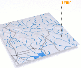 Places with similar names to Teibo, Nigeria ::
Disclaimer :: Information on this page comes without warranty of any kind |
||
|
Where is Teibo? Elevation and coordinates ::
Latitude (lat): 7°20'0"N Longitude (lon): 2°52'0"E
Elevation (approx.): 96m (map arrows pan, magnifying glasses zoom) |
||
|
Visiting Teibo? Hotel/Accommodation ::
Book a hotel in Teibo Travel Guide ::
Buy a travel guide for Nigeria rental cars ::
car rental offers GPS waypoint ::
download a GPX waypoint (PoI) of Teibo for your GPS receiver
|
||