|
search place name
|
||
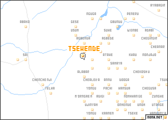
Tsewende (Gongola, Nigeria)Tsewende is a town in the Gongola region of Nigeria. An overview map of the region around Tsewende is displayed below.
regional and 3d topo map of Tsewende, Nigeria ::
Tsewende airports ::
The nearest airport is MDI - Makurdi, located 155.5 km west of Tsewende.
Other airports nearby include BPC - Bamenda (169.3 km south), FOM - Foumban Nkounja (228.3 km south), Nearby towns ::
Tsepian (1.9km north) //
Cheako (1.8km east) //
Chevgo (2.6km south east) //
Agbemda (3.7km north) //
Alabar (3.7km south) //
Gbando (4.1km north east) //
Abokpa Tyav (5.2km north east) //
Atawe (5.5km east) //
Chealeva (5.9km south) //
Usum (5.9km north) //
Jija (5.8km east) //
Agbede (6.6km north east) //
Samaya (7.6km east) //
Gese (7.6km north) //
Yongu (7.6km south) //
Azegetsu (7.8km north east) //
Annu (7.8km south east) //
Suwe (7.8km north east) //
Aligbo (7.8km south east) //
Fachi (9.2km south east) //
Gbundu (10.4km north east) //
Nomyugh (10.4km south east) //
Shonkyaa (10.4km south east) //
Yelwa (10.4km south west) //
[all distances 'as the bird flies' and approximate] 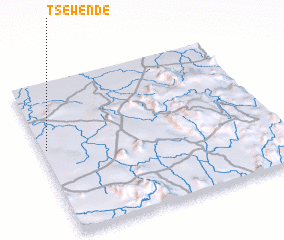 Places with similar names to Tsewende, Nigeria :: Disclaimer :: Information on this page comes without warranty of any kind |
||
|
Where is Tsewende? Elevation and coordinates ::
Latitude (lat): 7°34'0"N Longitude (lon): 10°1'0"E
Elevation (approx.): 181m (map arrows pan, magnifying glasses zoom) |
||
|
Visiting Tsewende? Hotel/Accommodation ::
Book a hotel in Tsewende Travel Guide ::
Buy a travel guide for Nigeria rental cars ::
car rental offers GPS waypoint ::
download a GPX waypoint (PoI) of Tsewende for your GPS receiver
|
||