|
search place name
|
||
Ukwa (Gongola, Nigeria)Ukwa is a town in the Gongola region of Nigeria. An overview map of the region around Ukwa is displayed below.
regional and 3d topo map of Ukwa, Nigeria ::

Ukwa airports ::
The nearest airport is PHC - Port Hartcourt Port Harcourt Intl, located 70.1 km west of Ukwa.
Other airports nearby include CBQ - Calabar (90.2 km east), SSG - Malabo (174.1 km south east), ENU - Enugu (183.3 km north), TKC - Tiko (216.4 km east), Nearby towns ::
Odoro Ikot (0.0km north) //
Ikot Ator Iwuo (1.9km north) //
Ikot Igwara (1.8km east) //
Ikot Awure (1.8km west) //
Uko Udo (4.1km north west) //
Ekeffe (4.1km south west) //
Ikot Ekpuk (5.8km east) //
Ikot Owobo (5.9km south) //
Ikot Ibritam (5.8km east) //
Ikot Etim (5.9km north) //
Ikot Udor Esiom (6.7km north east) //
Ikot Aka (6.7km north east) //
Ikot Inyang Nang Ita (6.7km south east) //
Mbiaso (6.7km south east) //
Nkwok (7.4km north) //
Uruk Otong (7.6km east) //
Obete (7.6km west) //
Oha Obu (7.8km north west) //
Ikot Akpan (8.3km north west) //
Luekue Banghan (8.3km south west) //
Nung Ikot (8.3km south east) //
Ikot Esien (9.3km north east) //
Ikot Okon (10.5km north east) //
Ikot Akpan Udo (10.5km south east) //
Idung Ntuk Uma (10.5km south east) //
[all distances 'as the bird flies' and approximate] 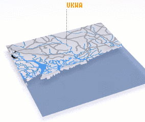 Places with similar names to Ukwa, Nigeria ::
Disclaimer :: Information on this page comes without warranty of any kind |
||
|
Where is Ukwa? Elevation and coordinates ::
Latitude (lat): 4°49'0"N Longitude (lon): 7°33'0"E
Elevation (approx.): 28m (map arrows pan, magnifying glasses zoom) |
||
|
Visiting Ukwa? Hotel/Accommodation ::
Book a hotel in Ukwa Travel Guide ::
Buy a travel guide for Nigeria rental cars ::
car rental offers GPS waypoint ::
download a GPX waypoint (PoI) of Ukwa for your GPS receiver
|
||