|
search place name
|
||
Womonle (Gongola, Nigeria)Womonle is a town in the Gongola region of Nigeria. An overview map of the region around Womonle is displayed below.
regional and 3d topo map of Womonle, Nigeria ::

Womonle airports ::
The nearest airport is IBA - Ibadan, located 46.4 km west of Womonle.
Other airports nearby include AKR - Akure (101.3 km east), ILR - Ilorin (132.2 km north), LOS - Lagos Murtala Muhammed (139.0 km south west), BNI - Benin (169.5 km south east), Nearby towns ::
Ibadan (0.0km north) //
Olokuta (2.6km south west) //
Moringbere (2.6km north west) //
Onibepe (2.6km north east) //
Aborisade (3.7km east) //
Abimbola (4.1km south west) //
Monlewo (4.1km south west) //
Alaha (4.1km north west) //
Atoba (4.1km south west) //
Origbo (4.1km south west) //
Oyere Fadehan (4.1km south east) //
Obeyin (4.1km north east) //
Oba (5.2km north west) //
Sango Diran (5.2km south west) //
Malekolo (5.2km south west) //
Oyere Kereja (5.2km north east) //
Ololo (5.6km north) //
Oyere Adedire (5.6km south) //
Orile Owu (5.5km west) //
Agboro (5.9km north) //
Oyere Asujo (5.8km east) //
Agboro (5.8km east) //
Kilibi (6.6km north east) //
Alagbede (6.6km south west) //
Oriokuta (6.7km north east) //
Alaro (7.4km north) //
Amo (7.4km east) //
Ajiboro (7.6km west) //
Jakankan (7.6km west) //
[all distances 'as the bird flies' and approximate] 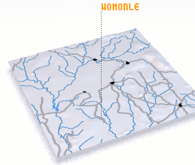
Disclaimer :: Information on this page comes without warranty of any kind |
||
|
Where is Womonle? Elevation and coordinates ::
Latitude (lat): 7°15'0"N Longitude (lon): 4°23'0"E
Elevation (approx.): 138m (map arrows pan, magnifying glasses zoom) |
||
|
Visiting Womonle? Hotel/Accommodation ::
Book a hotel in Womonle Travel Guide ::
Buy a travel guide for Nigeria rental cars ::
car rental offers GPS waypoint ::
download a GPX waypoint (PoI) of Womonle for your GPS receiver
|
||