|
search place name
|
||
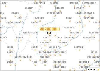
Wuro Gboki (Gongola, Nigeria)Wuro Gboki is a town in the Gongola region of Nigeria. An overview map of the region around Wuro Gboki is displayed below.
regional and 3d topo map of Wuro Gboki, Nigeria ::
Wuro Gboki airports ::
The nearest airport is YOL - Yola, located 69.4 km north east of Wuro Gboki.
Other airports nearby include GOU - Garoua (165.1 km east), NGE - N'gaoundere Ngaoundere (242.3 km south east), Nearby towns ::
Jakoli (0.0km north) //
Ngabelani (1.8km east) //
Ganglamja (1.9km south) //
Takan (2.6km north west) //
Piro (2.6km south west) //
Sakla (2.6km north west) //
Wuro Jato (4.1km south west) //
Diko (4.1km south east) //
Wuro Umaru (5.9km south) //
Wuro Manji (5.9km south) //
Bapinso (6.6km north west) //
Dummau (6.6km south east) //
Yanshuali (6.6km south east) //
Gangwaso Daudu (6.6km south east) //
Wuro Dore (6.7km north west) //
Wuro Yako (7.4km south) //
Mbambe Fulani (7.3km west) //
Taparu (7.3km east) //
Jauro Yahaya (7.6km south) //
Bula (7.6km south) //
Yelde Hindu (7.6km east) //
Sebore Dadoru (7.6km north) //
Gangwaso (7.6km east) //
Batisu (7.8km south west) //
Sobi (7.8km north west) //
Wuro Yuware (8.3km south east) //
Lamja (9.2km north east) //
[all distances 'as the bird flies' and approximate] 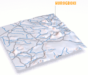 Places with similar names to Wuro Gboki, Nigeria :: Disclaimer :: Information on this page comes without warranty of any kind |
||
|
Where is Wuro Gboki? Elevation and coordinates ::
Latitude (lat): 8°51'0"N Longitude (lon): 11°57'0"E
Elevation (approx.): 454m (map arrows pan, magnifying glasses zoom) |
||
|
Visiting Wuro Gboki? Hotel/Accommodation ::
Book a hotel in Wuro Gboki Travel Guide ::
Buy a travel guide for Nigeria rental cars ::
car rental offers GPS waypoint ::
download a GPX waypoint (PoI) of Wuro Gboki for your GPS receiver
|
||