|
search place name
|
||
Wuro Tammai (Gongola, Nigeria)Wuro Tammai is a town in the Gongola region of Nigeria. An overview map of the region around Wuro Tammai is displayed below.
regional and 3d topo map of Wuro Tammai, Nigeria ::
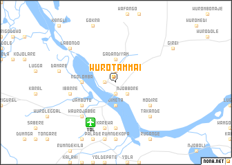
Wuro Tammai airports ::
The nearest airport is YOL - Yola, located 7.7 km south west of Wuro Tammai.
Other airports nearby include GOU - Garoua (99.3 km east), MVR - Maroua Salak (233.1 km north east), NGE - N'gaoundere Ngaoundere (247.9 km south east), Nearby towns ::
Kofare (1.9km north) //
Bajabure (1.9km south) //
Damare (1.8km west) //
Njobbore (2.6km south east) //
Gada Ndiyam (3.7km north) //
Jimeta (3.7km south) //
Ngolomba (5.5km west) //
Jambutu (6.6km south west) //
Modire (6.6km south east) //
Jalingo (7.4km south) //
Ibarre (7.5km west) //
Dolabe (7.5km west) //
Karewa (7.6km south) //
Wauro Jabbe (7.8km south west) //
Takande (7.8km south east) //
Labondo (9.2km north west) //
[all distances 'as the bird flies' and approximate] 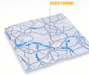 Places with similar names to Wuro Tammai, Nigeria ::
// Wardomy (PL)
// Wuro Adamu (NG)
// Wuro Adamu (NG)
// Wuro Adamu (NG)
// Wuro Adamu (NG)
// Wuro Dama (NG)
// Wuro Dumo (NG)
// Werdum (DE)
// Waardamme (BE)
// Wirdum (NL)
Disclaimer :: Information on this page comes without warranty of any kind |
||
|
Where is Wuro Tammai? Elevation and coordinates ::
Latitude (lat): 9°19'0"N Longitude (lon): 12°28'0"E
Elevation (approx.): 188m (map arrows pan, magnifying glasses zoom) |
||
|
Visiting Wuro Tammai? Hotel/Accommodation ::
Book a hotel in Wuro Tammai Travel Guide ::
Buy a travel guide for Nigeria rental cars ::
car rental offers GPS waypoint ::
download a GPX waypoint (PoI) of Wuro Tammai for your GPS receiver
|
||