|
search place name
|
||
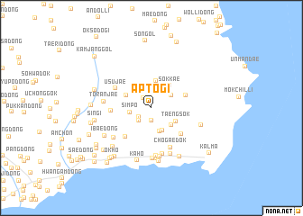
Ap'tŏgi (Hamgyŏng, Korea, North)Ap'tŏgi is a town in the Hamgyŏng region of Korea, North. An overview map of the region around Ap'tŏgi is displayed below.
regional and 3d topo map of Ap'tŏgi, Korea, North ::
Nearby towns ::
Karidŏk (1.2km north) //
Ch'op'yŏng (1.6km south) //
Hwangbyŏndŏk (1.5km north west) //
Chŭngsal-li (1.6km south west) //
Orip'yŏng (1.9km south west) //
Simp'o (2.1km west) //
Sŏngmakchang (2.4km north east) //
Paengmunp'o (2.4km north east) //
Nandŏk (3.0km south) //
Mayu-dong (3.0km south) //
Sangbaekt'ŏ (2.8km south east) //
Kanggŏn-dong (3.4km north) //
T'aengsŏk (2.8km south east) //
Pangp'o (2.8km north west) //
Sokkae (3.2km north east) //
Saebat'mok (3.6km north east) //
Tae-dong (4.3km south west) //
Such'im-dong (4.3km south east) //
Toranjae (3.8km west) //
Usujae (4.2km north west) //
Ch'ogaedŏk (5.2km south) //
No-dong (5.8km south) //
Ongdo-dong (5.9km south) //
Toranjae (4.6km west) //
Yŏnam (5.1km south west) //
Musudal-li (6.1km south) //
Taep'o-dong (6.0km south) //
Ch'angjŏn-dong (6.2km south) //
Noam (6.3km south) //
[all distances 'as the bird flies' and approximate] 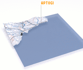 Places with similar names to Ap'tŏgi, Korea, North ::
Disclaimer :: Information on this page comes without warranty of any kind |
||
|
Where is Ap'tŏgi? Elevation and coordinates ::
Latitude (lat): 40°54'10"N Longitude (lon): 129°38'41"E
Elevation (approx.): 388m (map arrows pan, magnifying glasses zoom) |
||
|
Visiting Ap'tŏgi? Hotel/Accommodation ::
Book a hotel in Ap'tŏgi Travel Guide ::
rental cars ::
car rental offers GPS waypoint ::
download a GPX waypoint (PoI) of Ap'tŏgi for your GPS receiver
|
||