|
search place name
|
||
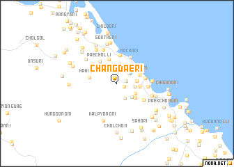
Changdae-ri (Kangwŏn, Korea, North)Changdae-ri is a town in the Kangwŏn region of Korea, North. An overview map of the region around Changdae-ri is displayed below.
regional and 3d topo map of Changdae-ri, Korea, North ::
Changdae-ri airports ::
The nearest airport is SHO - Sokch'o Sokcho, located 116.7 km south east of Changdae-ri.
Other airports nearby include KAG - Kangnung Gangneung (169.5 km south east), SSN - Seoul East Seoul Ab (181.4 km south), GMP - Seoul Gimpo (181.6 km south west), OSN - Osan Ab (221.2 km south), Nearby towns ::
Manyang-ni (1.0km south east) //
Changdong-ni (1.2km east) //
Sallol-li (2.3km north east) //
Such'ŏl-li (2.2km north east) //
Asal-li (2.6km south east) //
Changdŏng-ni (2.3km east) //
Kangdong-ni (3.1km north) //
P'ungyang-ni (2.5km east) //
Nosang-ni (2.9km south east) //
Ongma-ri (2.8km south east) //
Kuŭm-ni (2.8km east) //
P'ohang-ni (3.2km south east) //
Sŏkto-ri (3.1km north east) //
Yŏam-dong (3.9km north) //
P'aech'ŏl-li (4.1km north west) //
Koehwa-ri (4.5km north) //
Hahwa-ri (3.6km west) //
Hwangsŏng-ni (3.6km east) //
Mach'a-ri (4.5km north) //
Songjŏl-li (3.9km east) //
Sŏksŏng-ni (4.2km south east) //
Ch'un'gulmi-gol (4.4km north west) //
Chŭngŭm-dong (4.4km north west) //
Omae-ri (4.4km east) //
P'ungp'ae-ri (5.6km north) //
Much'i-ri (4.8km south east) //
Sint'al-li (5.9km north west) //
Harimong-ni (5.5km north west) //
Haimong-ni (5.5km north west) //
[all distances 'as the bird flies' and approximate] 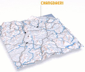 Places with similar names to Changdae-ri, Korea, North ::
// Chang Darreh (IR)
// Chhnŏk Tru (KH)
// Changuitiro (MX)
// Chankatyr (UZ)
// Shāh Nikdur (PK)
// Ch'angdae-ri (KP)
// Changdae-ri (KP)
// Ch'angdo-ri (KP)
// Ch'angt'ae-ri (KP)
// Changt'o-ri (KP)
Disclaimer :: Information on this page comes without warranty of any kind |
||
|
Where is Changdae-ri? Elevation and coordinates ::
Latitude (lat): 38°59'15"N Longitude (lon): 127°48'3"E
Elevation (approx.): 32m (map arrows pan, magnifying glasses zoom) |
||
|
Visiting Changdae-ri? Hotel/Accommodation ::
Book a hotel in Changdae-ri Travel Guide ::
rental cars ::
car rental offers GPS waypoint ::
download a GPX waypoint (PoI) of Changdae-ri for your GPS receiver
|
||