|
search place name
|
||
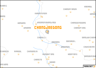
Changjae-dong (Hamgyŏng, Korea, North)Changjae-dong is a town in the Hamgyŏng region of Korea, North. An overview map of the region around Changjae-dong is displayed below.
regional and 3d topo map of Changjae-dong, Korea, North ::
Changjae-dong airports ::
The nearest airport is FNJ - Pyongyang Intl, located 100.3 km west of Changjae-dong.
Other airports nearby include GMP - Seoul Gimpo (199.5 km south), SHO - Sokch'o Sokcho (205.0 km south east), SSN - Seoul East Seoul Ab (213.5 km south), Nearby towns ::
Ch'ŏnŭl-li (3.1km south west) //
Un'gong-nodongjagu (3.5km north) //
Ch'ŏngnyong-ni (4.5km north west) //
Maemoru (5.0km south east) //
Yongp'yŏng-ni (5.4km north west) //
Kae-maŭl (7.0km north) //
Kwanp'yŏng-ni (7.3km north) //
Unsan-ni (6.2km west) //
Chosan (8.2km south east) //
Unhŭng-ni (8.2km south east) //
Chinsŏng-ni (9.3km south west) //
Sasŭl-gol (9.1km north east) //
Changnyang-ni (11.0km north east) //
[all distances 'as the bird flies' and approximate] 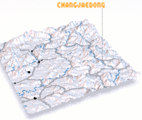 Places with similar names to Changjae-dong, Korea, North ::
// Changjae-dong (KP)
// Changjae-dong (KP)
// Changjae-dong (KP)
// Changjae-dong (KP)
// Changjae-dong (KP)
// Changjae-dong (KP)
// Changjae-dong (KP)
// Chŏngja-dong (KP)
// Chŏngja-dong (KP)
// Chŏngja-dong (KP)
Disclaimer :: Information on this page comes without warranty of any kind |
||
|
Where is Changjae-dong? Elevation and coordinates ::
Latitude (lat): 39°21'20"N Longitude (lon): 126°49'15"E
Elevation (approx.): 520m (map arrows pan, magnifying glasses zoom) |
||
|
Visiting Changjae-dong? Hotel/Accommodation ::
Book a hotel in Changjae-dong Travel Guide ::
rental cars ::
car rental offers GPS waypoint ::
download a GPX waypoint (PoI) of Changjae-dong for your GPS receiver
|
||