|
search place name
|
||
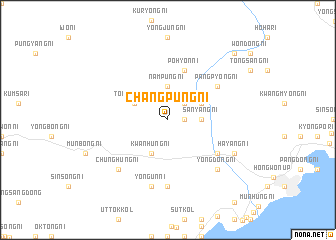
Changp'ung-ni (Korea, North)Changp'ung-ni is a town in Korea, North. An overview map of the region around Changp'ung-ni is displayed below.
regional and 3d topo map of Changp'ung-ni, Korea, North ::
Changp'ung-ni airports ::
The nearest airport is SHO - Sokch'o Sokcho, located 225.0 km south of Changp'ung-ni.
Nearby towns ::
Changnam-ni (1.4km east) //
Pusang-ni (2.3km north east) //
Sanyang-ni (2.8km east) //
Namp'ung-ni (3.7km north) //
Kwanhŭng-ni (4.0km south) //
Tongsang-ni (3.4km north west) //
Sinsang-ni (3.4km north east) //
Pohyŏn-ni (5.7km north) //
Yongdŏng-ni (5.6km south east) //
Pangp'yŏng-ni (5.6km north east) //
Pangjung-ni (5.6km north east) //
Unhŭng-ni (7.4km south) //
Yongun-ni (7.5km south) //
Chunghŭng-ni (7.0km south west) //
Yongdong-ni (7.0km south east) //
Ch'ŏngsu-ri (7.0km south east) //
Hayang-ni (6.8km south east) //
Koŭm-ni (6.8km south east) //
Yŏngdong-ni (9.3km north east) //
[all distances 'as the bird flies' and approximate] 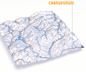 Places with similar names to Changp'ung-ni, Korea, North ::
// Changp'ung-ni (KP)
// Changp'ung-ni (KP)
// Ch'ŏngp'ung-ni (KP)
// Ch'ŏngp'ung-ni (KP)
// Chungp'ung-ni (KP)
// Changp'ung-ni (KP)
Disclaimer :: Information on this page comes without warranty of any kind |
||
|
Where is Changp'ung-ni? Elevation and coordinates ::
Latitude (lat): 40°5'0"N Longitude (lon): 127°51'0"E
Elevation (approx.): 127m (map arrows pan, magnifying glasses zoom) |
||
|
Visiting Changp'ung-ni? Hotel/Accommodation ::
Book a hotel in Changp'ung-ni Travel Guide ::
rental cars ::
car rental offers GPS waypoint ::
download a GPX waypoint (PoI) of Changp'ung-ni for your GPS receiver
|
||